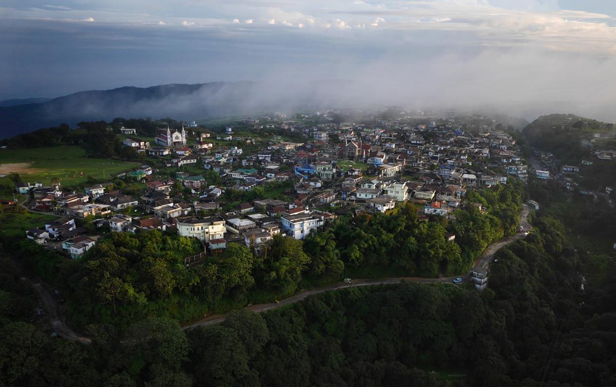
Shillong, the Scotland of the east…
Shillong, formerly called Yeddo or Lewduh, city, capital of Meghalaya state, northeastern India. The city is located in the east-central part of the state on the Shillong Plateau, at an elevation of 4,990 feet (1,520 meters).
Shillong first became prominent in 1864, when it succeeded Cherrapunji as the district headquarters. In 1874 it was made the capital of the new province of Assam. An earthquake destroyed the city in 1897, necessitating its complete rebuilding. The North-East Frontier Agency’s headquarters were in Shillong until that region became the union territory of Arunachal Pradesh in 1972. In that year Shillong became the capital of Meghalaya, which had been newly created out of territory that was formerly within the state of Assam.
Shillong, a popular tourist destination, is at the core of one of the largest urban areas in northeastern India. It is an important trade center for agricultural products and has research stations focusing on a dairy farm, fruit, and milk production. It also has the Pasteur Institute and Medical Research Institute and is the home of North-Eastern Hill University (founded 1973). The Barpani hydroelectric station lies a few miles to the north. Traffic congestion is a problem in the city.
Khasi people have long lived in the Shillong region. Large-scale migrations to Shillong took place following the partition of India in 1947. The immigrants were mostly from the portion of Assam that became part of East Pakistan (now Bangladesh). Pop. (2001) city, 132,867; urban agglom., 267,662; (2011) city, 143,229; urban agglom., 354,759.
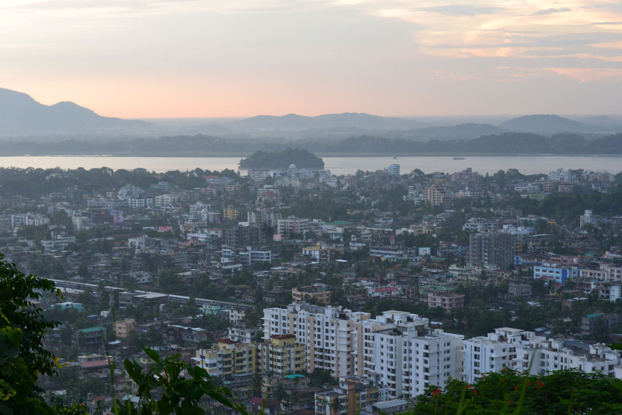
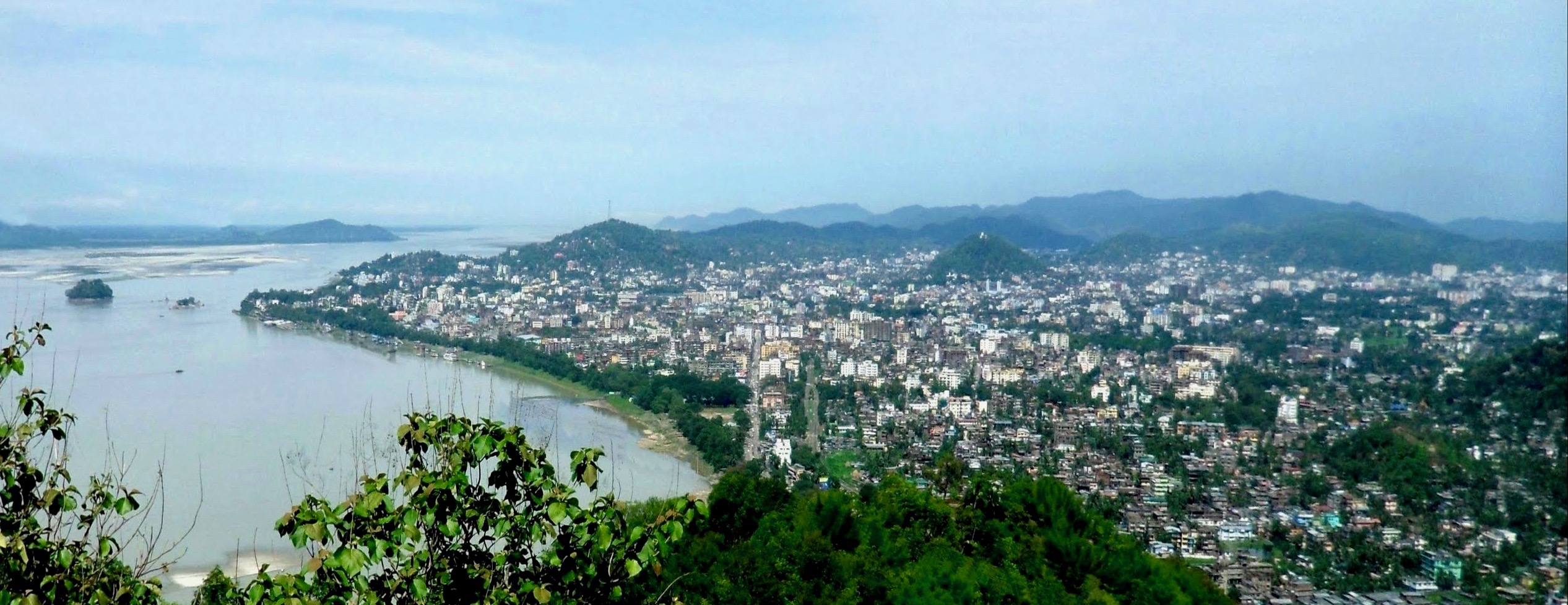
Guwahati
“Maharajadhiraja Shri Surendravarmana Kritam Bhagavata Valabhadra Swminayay Idam Guham”. These lines are from a rock inscription found in the Nilachal Hills, a few kilometers from Guwahati. It reads: “This cave (temple) of the illustrious Lord Balabhadra has been constructed by Maharajadhiraja Sri Surendra Varman.”
The inscription is estimated to date back to the 5th century AD, which makes it one of the earliest found in North-East India. Interestingly, it refers to a temple dedicated to Balabhadra, a god of the Vaishnavite pantheon, but the location of the temple—the Nilachal Hills—was largely the site with a Shaivite tradition. Notably, the inscription also helped historians establish the line of the Varman kings. (It mentions a “Surendra Varman”).
For the rest of us, though, it signaled something else—the existence of a city, Guwahati, for more than 1,500 years of recorded human history. The Nilachal rock inscription is incontrovertible proof that Guwahati has been home to a sizeable settlement for at least two millennia. The North-East has rarely figured in the imaginations of the bulk of Indian historians, and yet it has stood the test of time in its voyage through the ages.
The earliest description of the city of Guwahati cannot be distinguished from the mention of Pragjyotishpura kingdom, which, is estimated to date back far before the beginning of recorded history. As the legend goes, the kingdom of Pragjyotishpura was inhabited by the Kiratas and the Mleccha—generally depicted as addicted to meat and wine; their king Ghatak tall and powerfully built. Eventually, though, a king named Naraka defeated them and settled his own twice-born (Dvija, or Aryan) people in the region. (Today, about 5 km south of modern Guwahati, is a place surrounded by low-lying hills named Narakasur Gaon.)
Legend also has it that Naraka’s son Bhagadutta, a powerful ruler, organized the swayamvara of his daughter on a platform constructed in the middle of a large water body. Karna, the great warrior of the Mahabharata, won the tournament, but at his insistence, the princess’s hand was given to Duryodhana. The water body where this exchange is said to have taken place is called the Dighali Pukhuri today. In the epic tale of the Mahabharata, Bhagadutta fought for Duryodhana and the Kauravas in the final battle and later died an honorable death.
In recorded history, the Nidhanpur plate inscription of King Bhaskarvarman clearly mentions Naraka, his son Bhagadutta and his grandson Vajradutta as among the king’s ancestors. While genealogies in ancient times were often drawn in order to claim relations with a historical powerful ancestor and thereby legitimacy, the Nilachal rock inscription once again elucidates the past of the kingdom of Pragjyotishpura and the city now known as Guwahati.
Historians opine that after the death of King Bhaskarvaman, the old Guwahati was sacked (when was this?) by Salasthambha, one of Bhaskarvarman’s enemies, and it ceased to be of any prominence for the next three hundred years or so. The power vacuum perhaps leads to the growth of smaller but historically significant kingdoms like Beltola and Pandu.
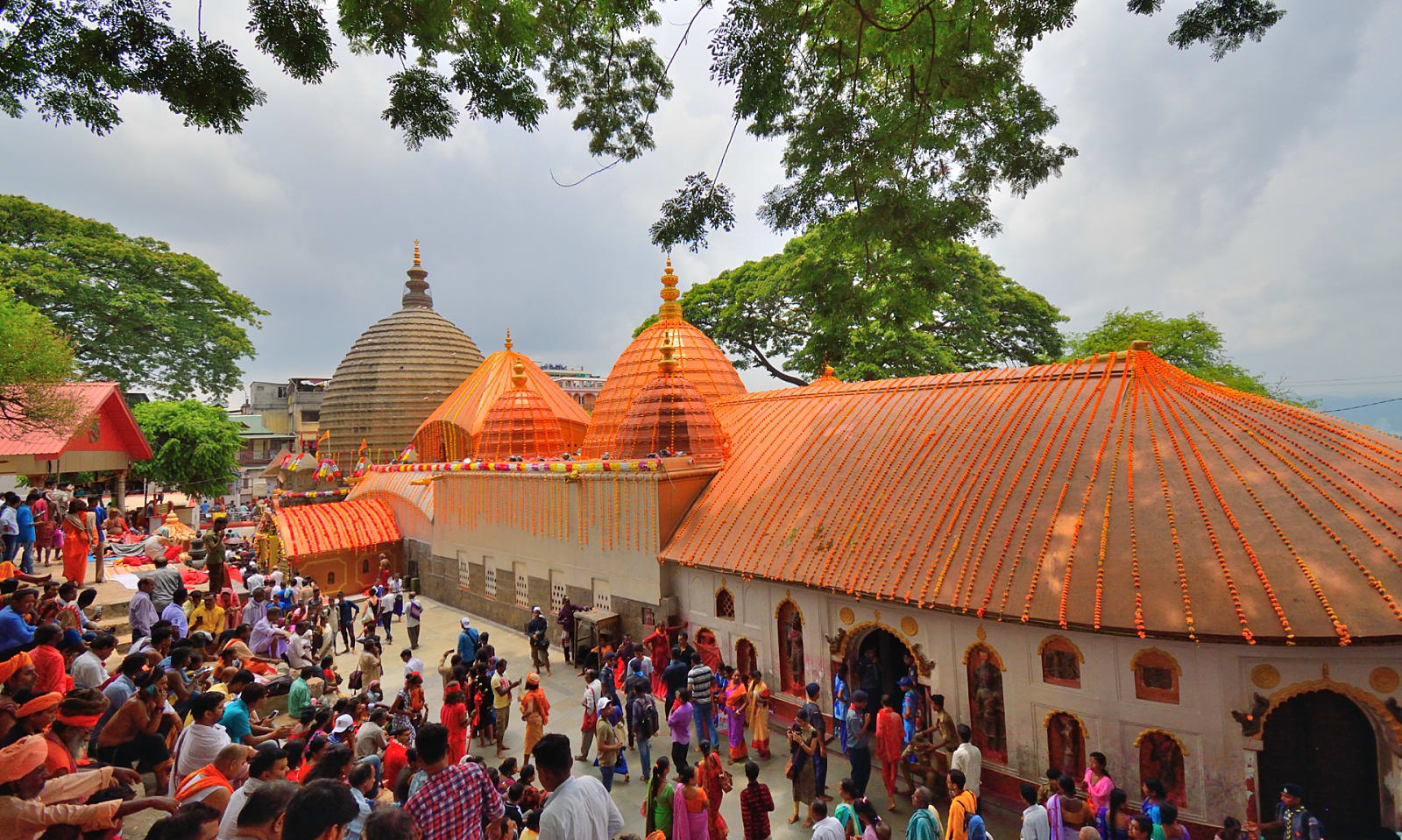
Guwahati itself was taken over by the Kachari rulers in later times, and subsequently, in the early medieval period, it passed into the hands of the Mohammedans. The Koch dynasty too held it for some time, which is evident from the fact that it was Chilarai–the younger brother of Nara Narayan, the king of the Kamata kingdom in the 16th century–who built the Kamakhya temple in its present form, which was later preserved and further strengthened by the Ahom kings in the latter half of the 17th century.
The Ahom kings finally dislodged all opposition and firmly established themselves in Guwahati when the viceroy of Lower Assam, the Borphukan, entrenched himself in Guwahati. When the administration passed onto the hands of the British, they modeled the city into its present form as the gateway to the North-East.
Mawsynram&Cherrapunji, the wettest places on earth!
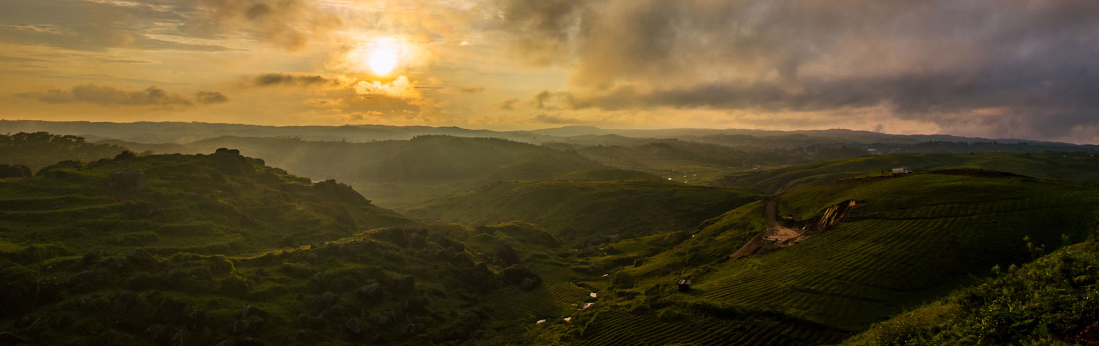
Slanting drops of rain slam the sodden earth like iridescent sheets of gunfire. They beat a steady drumroll on the houses scattered across the countryside. They glisten in the brown cows that stand as stock-still as the rocks. A pillar of cloud, like its biblical ancestor, leads the car I’m traveling in on a misty road that snakes into the distance. The wheels crunch over gravel and whirr through red mud as 26-year-old Rafe long, the Coldplay-loving taxi driver from Shillong, drives kamikaze-style to Mawsynram in the East Khasi Hills. Although I have a growing sense of kinship with Lord Cardigan, the luckless commander of the charge of the Light Brigade, I’m keen to visit the town that ousted Cherrapunji from the podium.
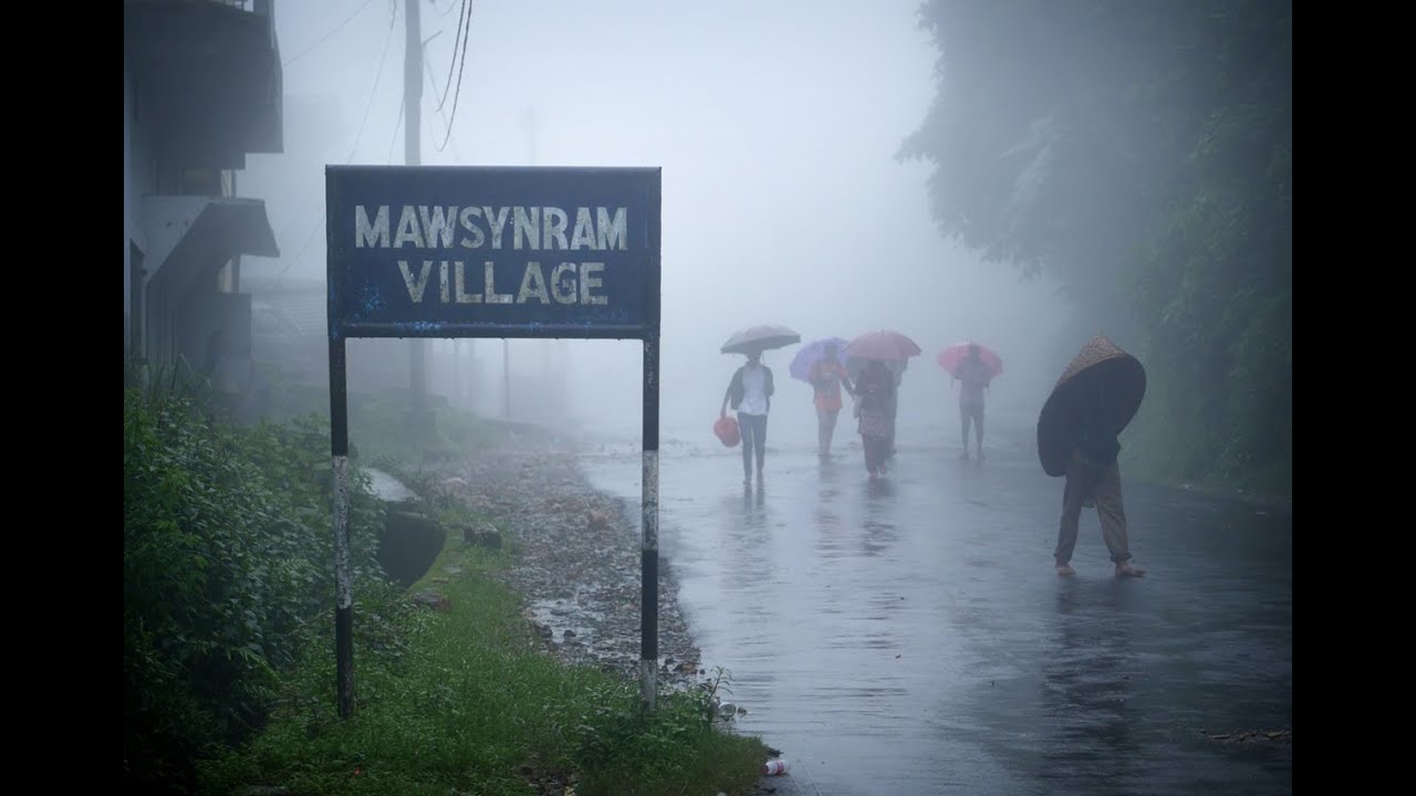
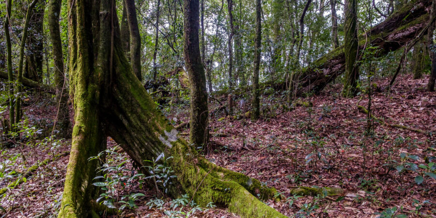
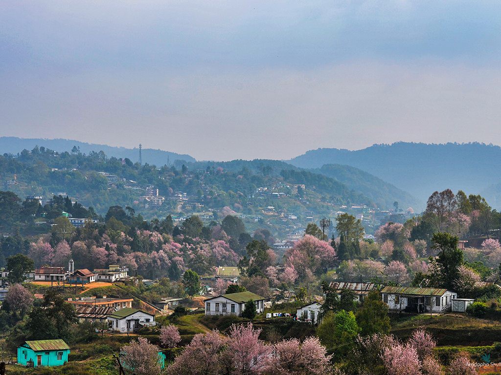
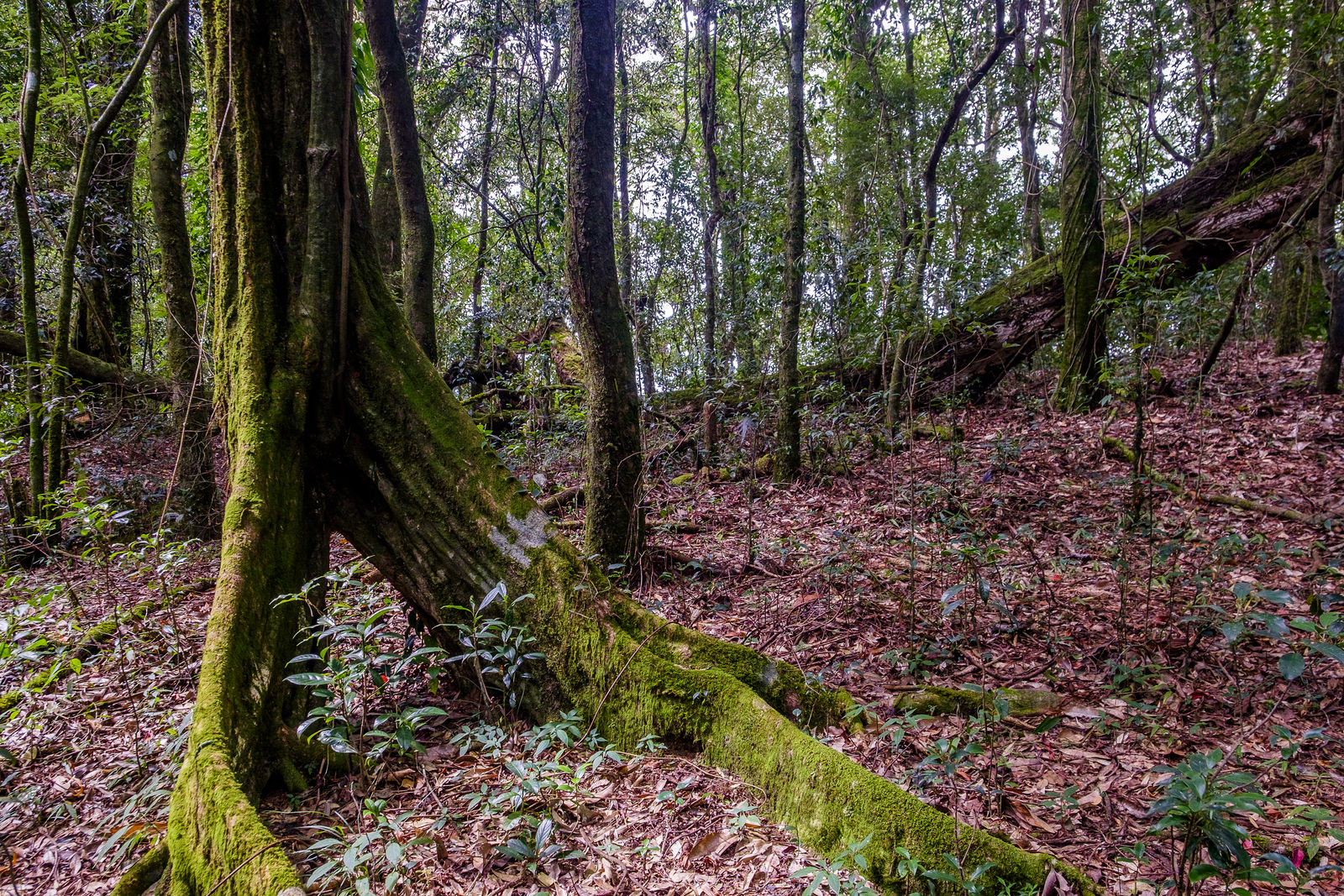
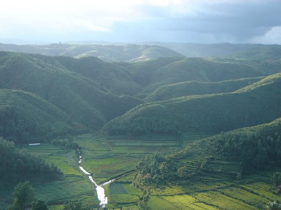
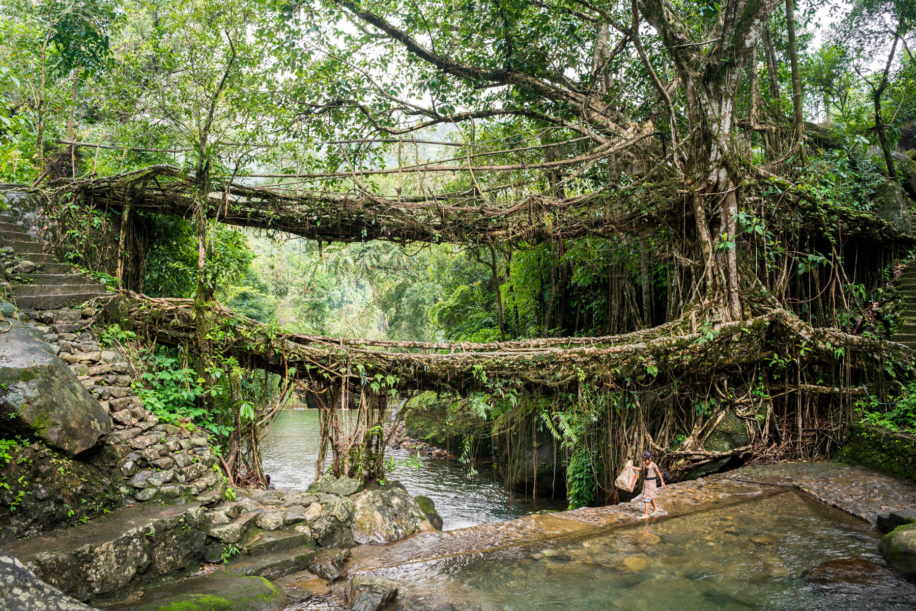
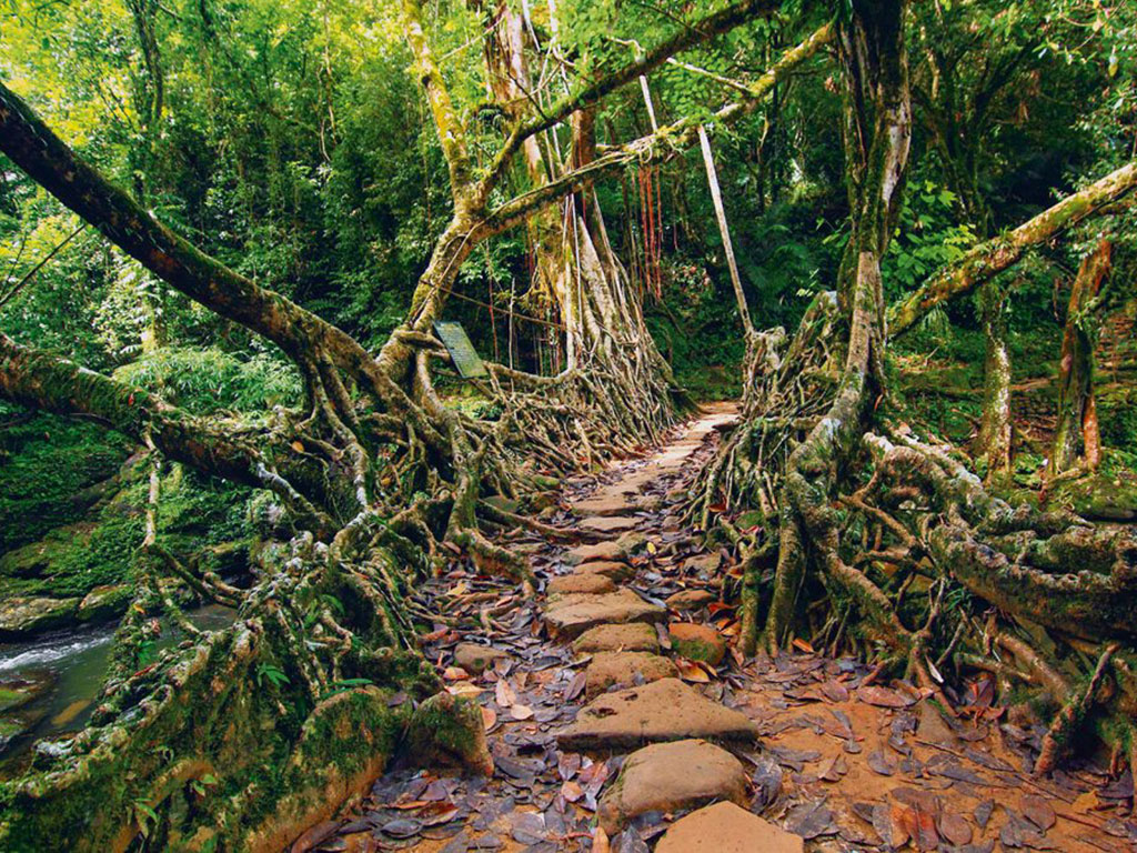
Shillong is still a charming town with its home-brewed brand of Western music, gracious cafés, and friendly people. But, the former capital of undivided Assam bursts at its seams, thanks to hordes of tourists who arrive to escape the heat of the plains and catch a glimpse of the monsoon. When you are done exploring its quieter suburbs crowded with clusters of pine and rhododendron, push on to discover the sacred groves at Mawphlang, the root bridges at Nongriat, Asia’s cleanest village at Mawlynnong, the underground caves at Mawjymbuin and the drizzly hills of Mawsynram.
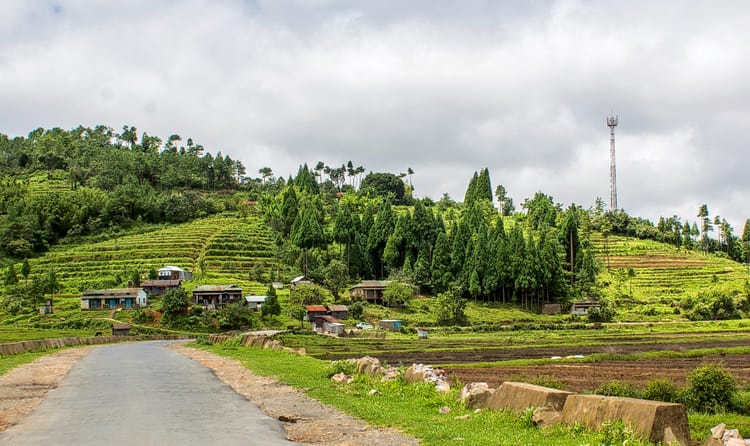
The road to Mawsynram is good, but the drifts of rain and spray from the innumerable gushing waterfalls that line it, and sometimes wash over it, lend poor visibility. Bamboo-splints divert water to the fields where farmers in wellingtons and knups — a tortoise shell-shaped shield made of grass and bamboo used as rain cover — are taking a bidi-break from turning over clods of earth. The countryside is an immodest green and frogs peep from under huge Jurassic-era ferns. Young men kick a ball covered in slush into the goalpost on a field. School kids scurry into classrooms, their socks surprisingly white and uniforms dry. Lunch is at Tyrsad — local rice with mashed potato and bland chicken gravy — in a lace-curtained roadside restaurant. “After this, we drive through forests,” says Rafe long. So, I decide to use the privy. It’s unbelievably clean, although its walls are swollen with damp and the water has a sheet of moss on it. We arrive at Mawsynram an hour later, fortified by steaming tea and vanilla cake.
With nearly 11,861 mm of rain, the equivalent of nearly 40 feet, the monsoon that runs for nearly 10 months makes rains at other places seem like a child’s tearful outburst. The subtropical highland climate and the showery rain keep the temperature below 20 degrees C. Summer air currents from the steaming Bangladesh plains to the South swarm up the hills, but when they squeeze through them they are forced to drop the rains here. It was through the same route that Christianity came to Meghalaya when Reverend Thomas Jones introduced the Khasis to Presbyterianism in 1841. Other missionaries followed suit, clambering over from Bangladesh, resulting in the countryside sprouting churches of various denominations. Tussocks of grass are thrown over the town’s tin roofs to lessen the noise of the maddening drizzle. I climb down a hillside and lose my footing on the moss-lined steps. I come up drenched, clutching handfuls of wet grass, feeling like one of the characters in a Jack London novel who wants to lie down and let the wolves pick her bones. A woman stops by, holding an umbrella over my head. Her brother gives me his hand. And, her mother leads me to their home for vanilla cakes and tea.
Cherrapunji, village, southern Meghalaya state, northeastern India. It is located on the Shillong Plateau about 35 miles (55 km) southwest of Shillong, the state capital.
Cherrapunji is noted for having one of the world’s highest average annual precipitation levels, about 450 inches (11,430 mm). In addition, it had the greatest recorded total single-year rainfall, 1,042 inches (26,467 mm) in August 1860–July 1861, and one of the greatest recorded one-month total rainfalls, 366 inches (9,296 mm) in July 1861. The heavy precipitation results from the village’s location on the plateau’s southern edge, at which point the saturated summer monsoon air rises up the southern slope and cools rapidly, releasing enormous quantities of condensed water.
The village serves as a trade center for the area’s agricultural products. The Cera coal mine is nearby. Cherrapunji was the capital of the independent Khasi states until it was succeeded by Shillong in 1864. It is still inhabited mainly by Khasi peoples, who are largely Christian and who have a matriarchal social system. Pop. (2001) 10,086; (2011) 11,722.


