

Member Type Contributor


Kanniyakumari, the “lands end’
September 28, 2020 in Tamilnadu
Kanniyakumari, the “lands end’ of India is one of the most popular tourist spots in the country. It nestles elegantly on the very tip of the Indian peninsula, at the confluence of the Bay of Bengal, the Arabian Sea, and the Indian Ocean. The town is at its best during the Chaitra Poornima (full moon day in April) when the Sun and Moon face to face at the same horizon. Other full moon days are also special when one can view the sunset and moonrise almost simultaneously.
Kumari Amman Temple: The legendary shrine is dedicated to the virgin goddess Kanniyakumari or Parvati. According to a mythological legend, the shrine marks the spot where the goddess prayed for Lord Shiva to come and claim her hand in marriage.
Vivekananda Rock Memorial: The memorial built-in 1970 on a rock in the sea, marks the spot where Swami Vivekananda, the great philosopher – guide, meditated at the end of 1892, before his departure to Chicago (USA), for participating in the World Religious Conference in 1893. It affords a fine view of the land’s end. Ferry services ply from the shore to the rock memorial at regular intervals.
Thiruvalluvar Statue: The 133 feet high statue of Tamil saint-poet Thiruvalluvar is set on a rock amidst Sea near Vivekananda Rock Memorial.
Gandhi Memorial: It marks the spot where the ashes of Mahatma Gandhi were kept in un for public viewing. The memorial is built in such a way that every year on 2nd October. the birth anniversary of Mahatma Gandhi, the sun rays fall directly on the spot where the urn of Mahatama’s ashes was displayed.
Kamaraj Memorial: The memorial on the seashore commemorates Thiru K. Kamarajar, the former Chief Minister of Tamil Nadu.
Govt. Museum: It has a rich collection of bronzes, coins, tribal objects, wood carvings, and zoological and botanical specimens. It also exhibits a “Temple Car” from Samythoppu and Wales Bones from Manavalakurichy.
Guganathaswamy Temple: This temple is said to have been built by Raja Raja Chola, about 1000 years ago.
 Around Kanniyakumari
Suchindram (13 kms.)
The famous Thanumalayan temple here is dedicated to Trimurthy-Siva, Vishnu, and Brahma. It is also noted for the magnificent gopuram, musical pillars, and an 18 feet statue of Lord Hanuman. The rich collection of art treasures from different periods is noteworthy.
Padamanabhapuram (45 kms.)
The capital of erstwhile Travancore state is set amidst lush hills and paddy fields, which lies 65 kms. southeast of Thiruvananthapuram. The impressive fort here has a Palace Ramaswamy temple and beautiful buildings. The Padamanabhapuram Palace is a masterpiece of Kerala’s unique wooden architecture. The oldest parts of the palace date back to 1550. It houses important art relics, while the temple is adorned with exquisitely carved panels depicting scenes from the Ramayana.

Rameswaram – Sacred Hindu Pilgrim
September 28, 2020 in Tamilnadu
The holy island in the Gulf of Mannar is regarded as one of the four most sacred Hindu pilgrim centers. It is also recognized as a National pilgrim center and is equally important for Saivites and Vaishnavites. Lord Rama is said to have worshipped Shiva over herè after his victory over demon king Ravanna. Rameswaram is als0 a lovely beach resort and a leading marine food center of the South.
Ramanathaswamy Temple: The magnificent shrine set elegantly near the sea on the eastern side of the island is noted for its imposing structure, spectacular corridors with aesthetically carved pillars, and splendid sculptures. It was built by rulers of different dynasties and covers an area of 264 meters x 200 meters. Its entrance is marked by a towering 38.4 meters gopuram. The main attraction is the world’s longest corridor, which is 197 meters long in East-West direction and 133 meters in length on South-North.
Agniteertham: The calm shallow sea in front of the Ramanathaswamy temple is considered to be very sacred by the devotees.
Gandhamathana Parvatham: This highest point on the island has a two-storeyed mandapam. It is believed to have an imprint of Lord Rama’s feet on a chakra.
Satchi Hanuman Temple: It marks the site where Hanuman gave the news of Sita’s well being to Lord Rama.
Five-faced Hanuman Temple: The stone said to have been used to construct the floating bridge – Sethu Bandanam can be seen here.
 Around Rameswaram
Annai Indira Gandhi or Pamban Bridge
The 2.2 kms. the long bridge connecting the Rameswaram island is the longest in India, constructed over a bay.
Devipattinam (Navabashanam) (70 kms.)
Lord Rama is said to have worshipped the ‘Navagrahas’ at this coastal village.
Dhanushkodi (18 kms.)
It is the southernmost tip of the island and is well known for the Kothandaramasamy Temple. There is also a fine beach here.
Kurusadai Island (20 kms.)
It lies to the west of Pamban Bridge and is noted for the Marine Biosphere.
Ramanathapuram (54 kms.)
This ancient town was the seat of the Sethupathis (Chieftains). The main attractions are the Ramalinga Vilasam Palace with fine paintings and the Tomb of Thayumana Swamigal.

Thanjavur, The Brihadeshwara Temple!
September 28, 2020 in Pilgrimages, Tamilnadu
 Thanjavur, the small town amidst the fertile Kaveri delta was the capital of the powerful Chola of kings. This grand showcase of Chola temple architecture was also an important seat of Tamil learning and culture. A distinctive art style developed here which is usually a combination of raised and painted surfaces. Lord Krishna is the most favorite theme of the famous Thanjavur school of art. Thanjavur is also the home of Carnatic music, musical instruments, dance, and traditional handicrafts.
There are many heritage sites in the southern part of our country and Thanjavur city of Tamilnadu is one of the places. Here, you can observe many cultural traditions. The Brihadeshwara Temple that is included in UNESCO’s World Heritage site is also situated in Thanjavur.
Just by entering here, you will feel like the old period of history has halted and if you are traveling by road then the clean roads will make you reach there soon and you will be fascinated by the archaeological significance. Thanjavur which is also known as Thanjavur is the administrative headquarters of Thanjavur district. The town is located in the Kaveri Delta that is at the distance of 300 from the Chennai city. The town was an initial capital of Chola from the ninth to the eleventh century and during the Vijayanagara Empire, Maratha, and British Reign, it was equally important. If you are trying to travel there, then take enough time for the tour so that you can travel to the town and as well as you can travel to many more tourist places. There are good facilities of government as well as private hotels to stay for tourists and pilgrims near their visiting destinations. The museum is located in the Library building to reveal the importance of the Library to the Public. This Museum is small but organized into sections highlighting ancient Manuscripts, Illustrated Manuscripts, Printed copies of the Original Drawings, Atlases, Thanjavur- style Paper Paintings, Canvass Paintings, Wooden Paintings, Glass paintings, Portraits of the Thanjavur Maratha kings, and the Physiognomy charts of Charles Le-Brun. These materials give an idea of the total variety in the vast collection within the Library.
View from the Bail Tower
If you will see the Bail Tower then you will notice that it makes the scene of some action film and sculptures that are made of brass and copper are also some place of attraction. The dome-shaped tower of the palace is the symbol of this town which is also a proof of best architecture. When the giant bell of this tower is ring then the whole town could hear it. The tower is made like this so that Kings could see the whole town. From this, we can learn that even in today’s world Dancing Towers, Bell Shape Towers, and Tree Shape towers are made.
Amazing Thanjavur Paintings
Thanjavur painting is a classical South Indian painting style, which was exposed from the town of Thanjavur and spread across the Tamil country. The art form draws its instant resources and inspiration from way back about 1600 AD, a period when the Nayakas of Thanjavur under the rule of the Vijayanagara Empire encouraged art, classical dance and music as well as literature, both in Telugu and Tamil, and painting of mainly Hindu religious subjects in temples. In Thanjavur paintings, one can see the power of Vijayanagara, Maratha, and even European or Company styles of painting.
Episodes from Hindu Puranas, Sthala-Puranas, and other religious texts were imagined, sketched, or traced and painted with the main figure placed in the central section of the picture surrounded by several supplementary figures, themes, and subjects. There are also many instances when Jain, Sikh, Muslim, other religious and even secular subjects were depicted in Thanjavur paintings.
Asia Oldest Library
Thanjavur Maharaja Serfoji’s Sarasvati Mahal Library is one of the oldest libraries in Asia and has on display a rare collection of Palm leaf manuscripts and paper written in Tamil, Telugu, Marathi, Hindi, and a few other languages native to India. The collection comprises well over 49,000 volumes, though only a tiny fraction of these are on display. The library has a complete catalog of holdings, which is being made available online. Since 1918 the Saraswathi Mahal Library has been a possession of the state of Tamil Nadu. Its official name of the Library was changed to “The Thanjavur Maharaja Serfoji’s Sarasvati Mahal Library” in honor of the great royal Marathon patron. The library is open to the public; it also supports efforts to publish rare manuscripts from the collection, as well as ensuring all volumes are preserved on microfilm. The Library has installed computers in 1998 for the Computerization of Library activities. As a first phase, the Library catalogs are being stored in the Computer for easy information retrieval. It is also proposed to digitalize the manuscripts of this Library shortly.

Ooty, the Queen of Hills
September 28, 2020 in Hill Station, Tamilnadu
 Udagamandalam, the Queen of Hills’ perched at an altitude of 7,500 feet, amidst the verdant Nilgiris or the Blue Mountains was first discovered in 1819, by John Sullivan, the then collector of Coimbatore. The ambient beauty of Ooty, the most popular hill station of the South. lies in its peaceful ranges surrounded by a misty blue haze. The colonial legacy of this British developed hill resort is still reflected in its terraced Botanical Garden. private schools, Ooty clubs, and churches.
Botanical Gardens: The English styled terraced gardens were founded in 1847, by Marquis of Tweed Dale. The garden sprawls across an area of about 22 hectares and has the most colorful collection of flora in Southern India. There are about 1000 varieties of plants, shrubs, and trees. The prestigious agro horticultural show, spring flower show, and dog shows are held here annually during April-May.
Ooty Lake: The picturesque lake set amidst the blue hills was built between 1823 and 1825, by John Sullivan. It has fine boating facilities with rowboats, paddleboats, and motorboats available on hire. The lake garden and toy train rides are other attractions.
Govt. Museum: It exhibits various tribal objects, representative sculptural arts and crafts of Tamil Nadu, and the ecological details of the Nilgiri district.
Raj Bhawan: The majestic building on the Dodabetta Ridge, near Botanical Garden. was built in 1877, by the Duke of Buckingham.
Kandal Cross: The Roman Catholic church is believed to enshrine a relic of the ‘True Cross’ on which Jesus Christ was crucified.
Rose Garden: The largest Rose Garden of India is perched on the lower slopes of Elk Hill at Vijayanagaram Farms. It has also become the first rose garden in the country to be recognized as a ‘Garden of Excellence’, by World Federation ofRose Societies.
The Museum: It was established in 1989 and exhibits timber, Kurinji flower, insects, butterflies, rocks, and wood carvings. Stone sculptures, bronze works, models of Toda hut, and coins can also be seen here.
Wenlock Downs: This stretch of about 20,000 acres of grassland with Sholas or gallery forest’ on the Gudalur road is about 8 kms. from the station. It is the most popular picnic spot in Ooty. The undulating landscape is blessed with splendid scenic beauty and rich vegetation. The Gymkhana Club, the Govt. Sheep Farm and Hindustan Photo Films Company are located here.
Some other attractions are – Stone House, St. Stephen’s Church, The Nilgiri’s Library, etc.
Around Ooty
Wellington (5 kms.)
The charming cantonment area on Coonoor – Ooty route famous for Aruvankadu, Pasteur Institute, Silk Worm Rearing Station and Stanley Park, etc.
Avalanche (28 kms.)
The area around the Avalanche or Canada Dam is endowed with great natural beauty. The lovely lake surrounded by thick Shola vegetation is ideal for hiking and fishing activities. Prior permission from the wildlife or forest departments is required.
Coonoor (19 kms.)
Coonoor, the second-largest hill resort of the Nilgiris after Udagamandalam (Ooty), nestles at an altitude of 1839 meters on a lower ridge of the main plateau. The beautiful town is surrounded by several picnic spots. It is also an excellent site for outdoor activities like bird watching, trekking, hiking, etc. The main attractions are – Sim’s Park, Pomological Station, Pasteur Institute, Law’s Falls (7 kms.), Ketti (8 kms.), Dolphin’s Nose (12 kms.), Lamb’s Rock (8 kms.), etc.
Dodabetta (10 kms.)
This highest peak (2638 m) of the Nilgiris and Tamil Nadu is accessible by road. Panoramic views of the Nilgiri hill ranges can be enjoyed from here.
Glenmorgan (17 kms.)
The scenic site is also known for Toda tribal settlements.
Kotagiri (28 kms.)
This charming little village is perhaps the oldest among the Nilgiri hill resorts, as the British started building activities here in 1819. Kotagiri is shielded by the Doddabetta ranges which receives much of its rain from the northwest monsoon. It is surrounded by verdant plantations and few Kota settlements.
Mudumalai Wildlife Sanctuary (64 kms.)
It is one of the most prominent wildlife sanctuaries of Tamil Nadu and the South. The thickly forested sanctuary covers an area of 321 sq. kms. bordering the Bandipur National Park in Karnataka and the Wyanad Sanctuary in Kerala. It is home to rich and varied species of animal life. The key fauna includes elephant, bison, sambar, barking deer, tiger, leopard, and a large number of smaller mammals like civet, cat, mouse deer. giant flying squirrel and many species of birds and snakes. An ‘Elephant Camp 5 kms. from the sanctuary is interesting. Elephants are bred here in captivity and trained for use in timber work. The park can be visited throughout the year, except for 3 months – June, July, and August. Regular buses are available for the park from Ooty and Mysore (94 kms.).
Mukurthi Peak& National Park (40 kms.)
The park was established in 1982, on the south-eastern corner of the Nilgiris plateau, and is dotted with several magnificent peaks. Its most famous inhabitant is the endangered Nilgiri Tahr. Other animal species commonly sighted here are – giant squirrel, sambar, and barking deer, gaur, wild boar, and wild dog, etc. One may also encounter wild elephants, tigers, and leopards in the park. The avifauna of the park includes kestrel, peacock, black eagle, and jungle fowl. The fascinating feature of the park is its endemism and relationship with the Himalayan flora and fauna. The headquarters of the park is at avalanche and the best time to visit is from February to June.
Have A Bath In The Sacred Yamuna!
August 28, 2020 in Delhi, Uttar Pradesh
 The Yamuna, which is the principal tributary of the Ganges, runs almost 1400 km through the states of Uttaranchal, Himachal Pradesh, Haryana, Delhi, and Uttar Pradesh, before it meets the Ganges at Allahabad. It also creates physical state borders between Himachal Pradesh and Uttaranchal and further down, between Haryana and Uttar Pradesh. Along with its tributaries, it forms the highly fertile Indo- Gangetic plain, which supports almost 57 million people, making it one of the most populated regions in the world. The Yamuna alone is responsible for more than 70 percent of the water supply in the National Capital Region.
While the Ganges has always been associated with benevolence and redemption, the Yamuna, her geographical twin, which rises close to the same glacial source has rather uncanny associations with death.
According to legend, Yama (the god of death) and Yami (Yamuna) were twins born to Surya (the sun god) and Samjna (consciousness). The identity of Yamuna as Yama’s twin in some religious texts and as his life-partner in others continues intermittently throughout Vedic literature. References can be found in the tenth book of the Rig Veda, where Yami desires Yama and begs him to yield to her. However, Yama remains adamant in his refusal. Despite this confusion, being associated with Yama gave the Yamuna the power to grant a kindly death. On the day of Bhratridwitiya (during Diwali) sisters pray to Yama and Yamuna for the long and prosperous lives of their brothers.
A Brahmanic tale narrates that Yama was the first mortal to die, leaving behind a disconsolate Yami. During the early stages of creation, the concept of the night did not exist and the days ran into each other as one continuous stretch. Because of this, it became extremely difficult for Yami to accept her loss, as time seemed to stand still. The gods were worried about Yami’s condition and decided to intervene. They created the night and it was decided that darkness would envelop the earth between the time of Yama’s death and Yami’s notion of the present moment, which was stagnant. As darkness broke the monotony of continuous daylight, it helped lessen Yami’s grief and eventually enabled her to distance herself from the death of her partner.
Another story narrates how the Yamuna came to be named. Unable to tolerate the brilliance and heat that her husband Surya emanated, Samjna would shut her eyes in his presence. The sun god was greatly annoyed by his wife’s behavior and chided her. Although Samjna tried to keep her eyes open, her best efforts failed, as the radiance made her eyes water. Surya told his wife that since her eyes fluttered in his presence, the daughter born to them would be wayward and would be called the Yamuna. However, he assured her that the Yamuna would be worshipped as a goddess. The waywardness of the river is borne by the fact that the Yamunotri temple in Uttaranchal (the principal shrine of the goddess) has to be repaired every few years due to the destruction caused by avalanches and landslides.
Most casual travelers and pilgrims consider Yamunotri to be the source of the Yamuna. However, this is far from accurate for the geographical source of the river is Saptarishi Kund, a glacial lake above Yamunotri. Blocked by snow for most of the year, it is accessible only to experienced trekkers. The lake derives its name from the seven great sages who lived here and performed great penances.
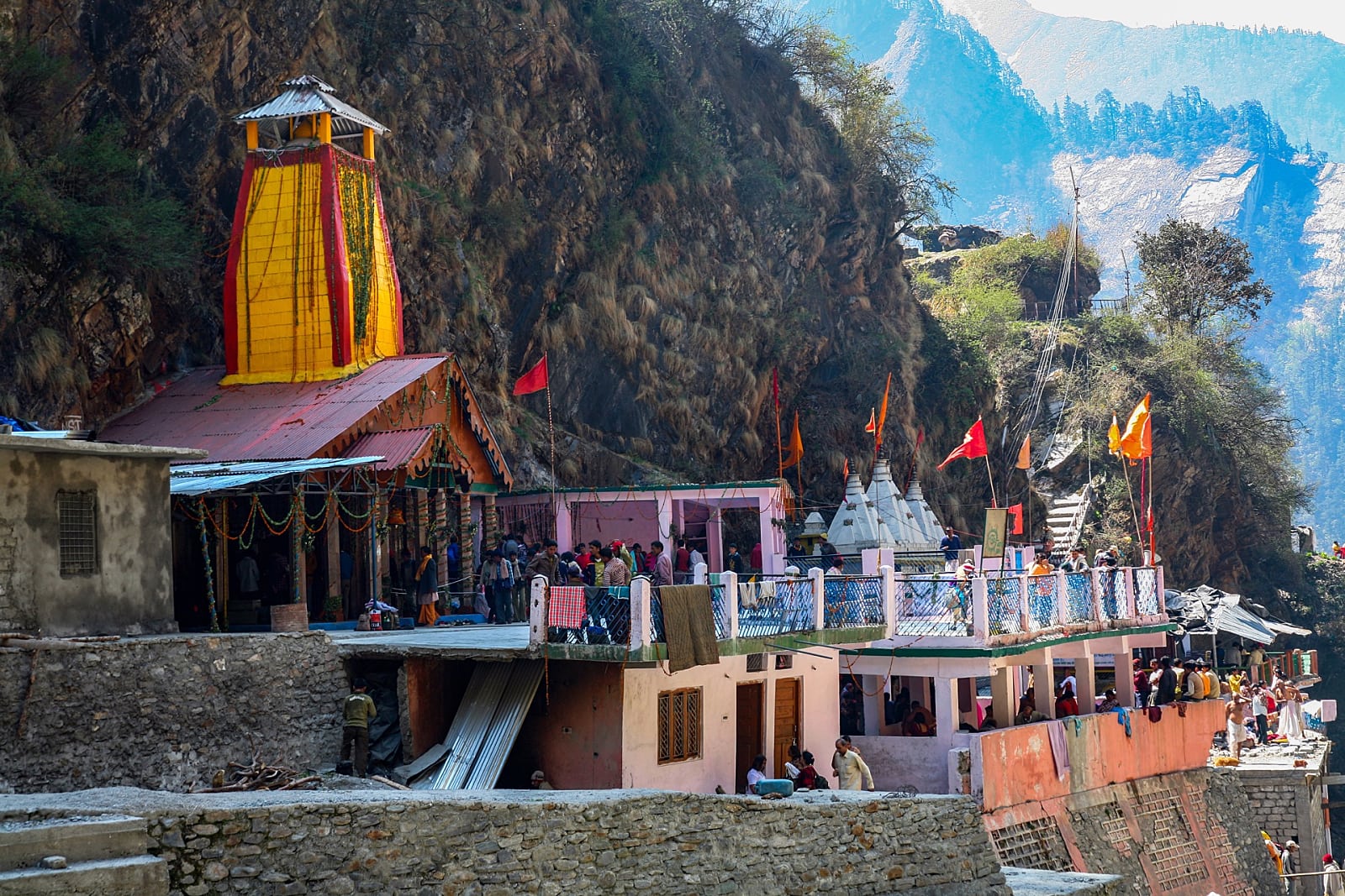 To reach Yamunotri, one has to first reach the quaint village of Janki Chatti, (approximately 90 km from Rishikesh.) From Janki Chatti, a steep 5 km trek along the feeder streams of the Yamuna leads to a ridge below the shrine. The gradient gradually reduces and the path opens out to a semicircular gorge above which the Yamuna begins her descent. From here, it is an easy ramble across a rusted bridge to the temple. The escarpment above the gorge has been decapitated to provide space for ever-proliferating hotels and dharamshalas. The far side of the gorge below the escarpment is full of natural chimneys that spew hot water and steam from geothermal springs, creating a blanket of mist. A careful glance through this camouflage exposes how apathy and a lack of civic sense can destroy a river. Mineral water bottles and plastic bags float downstream, trying hard to make their escape into the plains where environmentalists can discuss them at length.
The temple itself is a modest structure overlooking the gorge, surrounded by the usual plethora of shops that cater to pilgrims. Just below the temple is a tank where water from the hot spring is mixed with cold water to facilitate bathing. Water temperature in the smaller tank near the sanctum exceeds 70 degrees centigrade rice and lentils cooked here are offered to the pilgrims as prasad.
From Yamunotri, the river flows for about 200 km cutting across the Shivalik Range in the lower Himalayas, where it is dammed. The Assan Barrage on the Uttaranchal-Himachal border in the Doon Valley is situated at the confluence of the Yamuna Canal and the Assan River. This man-made wetland also supports a bird sanctuary. From here, the Yamuna flows towards Paonta Sahib, an important center of the Sikh pilgrimage. In 1685, Guru Govind Singh established a new township here after his return from Nahan. A fort-like structure was constructed on the banks of the river, part of which houses the gurudwara and a museum. Weapons used by Guru Gobind Singh during his stay here are on display.
The Yamuna then enters the Yamuna Nagar district of Haryana where the Tajewala Dam splits it into two channels, the Western Yamuna Canal (WYC) and the Eastern Yamuna Canal (EYC). The latter irrigates the states of Haryana and Uttar Pradesh, while the former crosses Yamuna Nagar, Karnal, and Panipat before reaching the Haiderpur treatment plant, which supplies potable water to the NCR region.
 Palla Village, 15 km upstream of Wazirabad Barrage (the reservoir for Delhi) is where the Yamuna enters the capital. Although the National Capital Region is the major source of contaminants, Yamuna’s tryst with pollution starts further upstream. There is a parallel channel from Tajewala, which receives both domestic and industrial waste. Sometimes when excess water from the WYC is let into it, the overflow causes pollutants to enter the clean water channel downstream at Karnal. Thus, there is a sudden increase in the pollution levels at the Haiderpur treatment plant a few times annually. Although organic waste can be treated effectively, removing traces of pesticides and fertilizers through conventional methods is not possible.
This only constitutes a minor threat to the Yamuna’s riverine ecology when compared to the level of contamination that Delhi, the biggest culprit, generates. The National Capital produces 1,900 mld of sewage, against an installed wastewater treatment capacity of 1,270 mld. Thus, almost 630 mld of untreated or partially treated sewage enters the river every day. The Wazirabad Barrage releases very little water in the dry months and only effluents flow downstream.
The Agra Canal splits from the Yamuna at the Okhla Barrage, which is the exit point for the river in Delhi. During the summer months, practically no potable water is released from here; instead, discharge from the Shahdara drain joins the river downstream carrying effluents from east Delhi and Noida. This is the second-largest polluter of the river after the Najafgarh drain. Today, the municipal water supply in the NCR is so polluted that it is impossible to drink it without secondary filtration. But this only takes care of organic waste; the chemical residue remains intact. While this may not pose a major problem for those who can afford bottled water, it is the less fortunate who suffer. The region is facing an acute water crisis with soaring costs to public health due to pollution and water-borne diseases. Lopsided Government policies on the water are also responsible for the crisis. In India, potable water is almost free, and this results in tremendous amounts of wastage.
After Delhi, the Yamuna is reduced to a drain for most of the year. The almost lifeless river slowly meanders towards the twin towns of Vrindavan and Mathura, which are famous for their association with the Hindu god Krishna. Mathura is a site of great antiquity. By the 5th century BC (during Buddha’s time), it was a major metropolis and capital of the Surasena Kingdom. The town continued to prosper under the reign of the Kushanas and remained a center of power during the Mauryan period from 3 century BC to 4th century AD. By the time Mahmud of Ghazni arrived in 1071 to play his favorite sport of pillage, Buddhism had completely disappeared from this region. Sikandar Lodi did further damage to the shrines of Mathura in 1500. The town regained its prominence under the auspices of the tolerant Akbar and Jehangir, only to be destroyed by Aurangzeb again.
According to legend, Mathura is the birthplace of Lord Krishna. Today, this little town is still redolent with the legends and music of the frivolous flutist.
As soon as one enters the over-congested town, the significance of Krishna in the lives of locals becomes evident. Calendar images of the godchild are plastered on virtually every surface. Walking through the narrow streets is a rather eerie experience with a million Krishnas watching you. Pilgrims, amateur flutists, overfed cattle, and cycle rickshaws share the street with little or no malice. Wayside shrines and sweet shops block pedestrian paths; the latter try their very best to ensure that the pundits maintain their full-figured appearance. In the morning, the combined throngs seem to have a singular agenda and they all Converge at the riverfront.
A broken path through a dilapidated archway descends to the bathing ghats where hundreds of pilgrims congregate to seek Yamuna and Surya’s blessings. Chirpy young women selling floral tributes and monkeys hoping to snatch a meal block the edges of the path. Pundits and astrologers sit on raised platforms in the arcaded colonnades waiting patiently for customers.
A long line of picturesque ghats adorns the riverfront. Painted by the sun’s gloaming brush, arched gateways and temple spires are reflected in the calm waters of the Yamuna. The peal of temple bells echo across the ghats; ill-tempered bulls bellow and harassed pilgrims grumble while Krishna bhajans are doled out through loudspeakers. Only the women bathing discreetly in their saris are oblivious to everything. They dream of their doe-eyed god and know that he will blind any mischievous sprite that dares gawk at them.
Vrindavan, a village 10 km north of Mathura (once noted for its fragrant groves) is where Krishna spent an exciting youth. While he spent much of his time vanquishing demons, he was legendary for his ability to mesmerize the village belles with the music of his flute. He also regularly hid their clothes while they bathed in the Yamuna-an activity that made him a hero in the eyes of most young men.
There are two overgrown gardens in Vrindavan: Seva Kunj and Nidhi Van. While the former is believed to be the place where Krishna and his female companions indulged in mortal pleasure, the latter is where they rested.
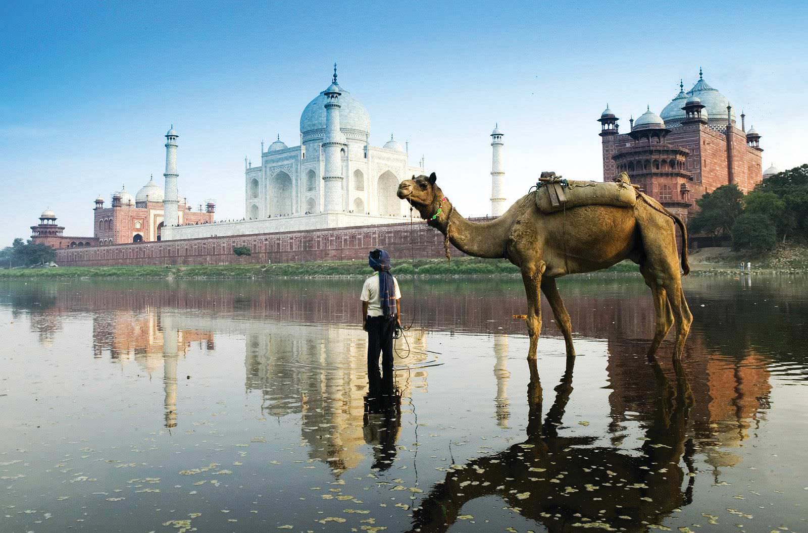
 But look beyond the edifice and the callousness of the local administration becomes evident; Agra is one of the most polluted towns in Uttar Pradesh. One only has to walk behind the monument (along the Yamuna) to see how farcical the measures to curb pollution have been. While the state of the art dustbins has been installed on the premises of the Taj, with ominous signs that ensure non-littering, very few know that garbage is dumped regularly behind the monument. The level of pollution is so high, that fish kills along this stretch of the river are a regular occurrence.
The Yamuna merges with the Ganges at Prayag, which is one of the most famous Hindu pilgrimage towns in India. In 1583, the Mughal Emperor Akbar renamed the city Allahabad. Incidentally, the ‘Allah’ in the name does not signify god in Islam. The usage of the word comes from Din-llahi-the syncretic religion Akbar experimented with. Hindus believe that Brahma offered his first sacrifice here after creating the universe.
Allahabad enjoys a position of great prominence in Hindu religion and mythology, as it is situated at the confluence of the Ganges and Yamuna. Hindus also believe that the River Saraswati has managed to escape extinction by descending vertically through a subterranean passage and joining her sacred sisters here.
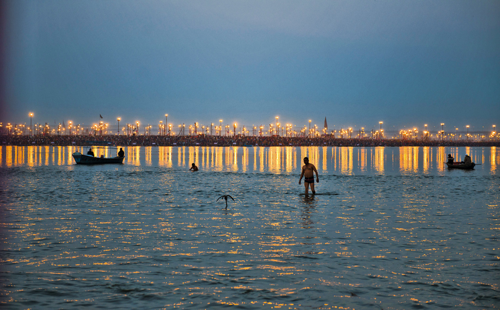
In the medieval period, as the neighboring Sharqi Dynasty of Jaunpur witnessed a fluctuation in its political fortunes, Allahabad gradually rose in importance and acquired the status of a Mughal Suba (state). Acknowledging the immense navigational potential of its rivers and the entrepreneurial importance of the city as a center for boat-making, Akbar built a fort here, overlooking the Yamuna. Today, only flat-bottomed riverboats ferrying pilgrims ply on this stretch and the fort is now an army garrison. The confluence of the Ganges, Yamuna, and now extinct Saraswati is called the Sangam and is the holiest spot in Allahabad. Temporary platforms are erected for the hundreds of pilgrims who come every day to offer prayers. During the Kumbh Mela, this number can swell to millions.
In theory, the Yamuna ends her journey here; but ask any In pilgrim and he will beg to differ, for the Yamuna just pauses here before accompanying the Ganges on a long journey to the sea.

The Narmada “Life Line of Madhya Pradesh & Gujarat”
August 28, 2020 in Gujarat, Madhya Pradesh
If rivers could be rated according to grace, the Narmada would be the strongest contender. The river runs a rather picturesque course from its point of origin, to where it meets the sea. The watershed of the Amarkantak Plateau where the Narmada begins its journey also feeds the Sone River. While the former flows westwards towards the Arabian Sea, the latter flows in a northwesterly direction and joins the Ganges.
 The Narmada originates at the meeting point of the Vindhya and Saputara Ranges on the crest of the Maikal Hills. Its mythical source is not far from its geographical origin. The spring-fed temple tank of Narmada Kund, which is surrounded by temples dedicated to the river goddess, is believed to be the source of the Narmada. Like many other temples, the water is channeled through a stone snout into a tank that serves as both cattle trough and a public bath.
The Narmada is the fifth-longest river in India and runs approximately 1300 km. It is also the largest west flowing river and forms the traditional boundary between the northern and southern parts of India. Considered among the holiest of Indian rivers, it is believed that a mere glimpse of its waters can deliver salvation and this is a constant influence in the lives of people who live along its banks. This has ensured that some of the most prominent centers of pilgrimage in central India are sited along its course. While the geographical origin of the river is attributed to a fault line in the earth’s crust, there are many legends about its mythological origin.
Once there were severe drought and famine-like conditions on earth. The gods petitioned Shiva to relieve humanity from this terrible situation. Shiva meditated for several days to sort out the problem and so intense was his meditation that he began to perspire profusely. Droplets of his perspiration fell to the ground and from it developed a beautiful maiden with whom all the gods became besotted. They pursued her hopelessly, but the divine lady kept eluding them. Shiva was extremely amused by the situation and named her ‘Nar Mada’ (one who gladdens the hearts of men) and requested her to flow for the salvation of mankind. In the Narmadeshwar Temple at Amarkantak, the goddess is seated on her crocodile mount (a common attribute of river deities). In her four arms, she holds objects that reinforce her essence, one of them being a Shivaling that signifies her devotion towards her father and creator.
Yet another legend narrates that a couple of teardrops that fell from the eyes of Brahma (creator of the universe) yielded two rivers-the Narmada and the Sone.
Celestial romances and weddings have always been an integral part of Hindu lore. It is not surprising then, that this theme features in a legend associated with both the Narmada and Sone, who were deeply in love with each other. However, just before their nuptials, the groom-to-be succumbed to the flirtations of another rivulet, and the livid Narmada stormed-off to the west vowing to remain a virgin.
According to some versions of the Puranas, Narmada was incarnate of Tapti (the daughter of Surya and Chaya). She is also said to be the sister of Shani (Saturn) and Savitri (Parvati), which makes her particularly auspicious. It is believed that the Ganges visits her once a year in the guise of a black cow to cleanse herself of accumulated sins. Pilgrims often undertake the Narmada Parikrama (circumambulation of the river), an arduous journey of 2600 km from Bharuch to Amarkantak, and then back again.
History and legends apart, the Amarkantak Plateau where the river rises, is one of the most scenic hill stations in central India. The river meanders through a thick blanket of deciduous forests until it reaches the edge of the plateau. From here, it splits into two channels and cascades down a 150-foot drop as the Kapildhara Falls. The two streams meet a short distance away and flow towards Dindori, (90 km from Amarkantak) where the river becomes wider as it is joined by several other rivulets.
This region is rich in fossilized mollusks that date between 40 and 200 million years and offers enormous possibilities in the study of the formation of landmasses between the Tertiary and Jurassic periods. In 2002, the fossil of a large carnivorous predator christened the Rajasaurus Narmadenis was excavated in the same belt. This reptile, which measured 30 feet in length and over 10 feet in height, lived around 67 million years ago. Paleontologists have unearthed hundreds of fossilized dinosaur eggs between Dahod and Jabalpur. Interestingly, one of the largest and earliest tyrannosaur fossils ever found, which is now on display in the British Museum of Natural History, was also excavated in the same area.
Unlike most rivers in central and southern India, the Narmada descends in a series of great cascades until it reaches the plains. Near the town of Mandla, at the Shahasradhara falls (thousand cascades) the river is broken up into several swiftly moving streams by huge basaltic formations. Locals believe that these rocks are remnants of an ancient dam; however, there is little archaeological evidence to support this theory.
The tiny island of Maheshwar is one of the better-known religious sites in the middle course of the river. According to local lore, it is situated at the center of the universe, on the axis which connects the center of the earth to the polestar. The island has an intimate connection with the Holkar Dynasty; in the 18th century, it served as their capital. During this period, the town was embellished with numerous public works, which includes Rani Ahilvabai Holkar’s fort that towers over the riverfront and provides a magnificent panorama of the Narmada. Maheshwar is also famous for its handloom industry, especially for the unique Maheshwari sari that takes its name from the town.
Downstream at Omkareshwar, the river splits into two channels before re-joining in an ‘Om’ shaped oxbow formation. The island formed thus, is one of the most important centers of Shaivite worship in central India. Amid the numerous relics of the Brahmanic era, which include shrines in various stages of dilapidation, the Shri Omkar Mandhata temple stands out like a jewel. One of the twelve Jyotirlinga shrines of Shiva, it makes the island particularly propitious. Steps from the temple lead to the bathing ghats where eager boatmen in gaily-colored boats wait for passengers.
 Omkareshwar is also the point where the pro and anti-dam dispute begins. Until recently, the people of Omkareshwar had to rely on oil lamps and lanterns. Following the construction of a dam just upstream, they have benefited greatly. Not only has the dam employed the locals, but now they also enjoy an uninterrupted power supply. However, while the villages downstream have profited from the dam, many villages in the reservoir areas are now submerged. This very saga of displaced villagers and farmers gave birth to the Narmada Bachao Andolan. The width of the river gradually reduces as it flows past the agricultural town of Khalghat. The picturesque town of Barwani in the Nimar district is the last important settlement along the river in Madhya Pradesh. Surrounded by the Satpura Hills, it rises from the lush Narmada Valley and is often referred to as the Paris of Nimar’.
Barwani is also the focal point of the Narmada Bachao Andolan (NBA), a movement that was spearheaded by the environmental activist Medha Patkar. The construction of large dams on the Narmada and its impact on the millions of people living in the river valley has become one of the most controversial social issues in contemporary India. The NBA’s opposition to the construction of large dams on the river symbolizes the struggle for an impartial society. Harping on the development card, the government plans to build 30 large, 135 medium and 3000 small dams to harness and channelize the water of the Narmada and its tributaries. However, opponents of the dam question the human cost and ecological sustainability of such large projects. They also believe that water and energy can be provided to the people of the Narmada Valley and Gujarat through alternative environmentally sustainable technologies. While both proponents and opponents of the dam refuse to back down, the people of the Narmada Valley will have to wait and watch which way the tide turns.
From Barwani, the river flows on through a small part of Maharashtra before entering the state of Gujarat. The narrow river then gets a new lease of life at Chandod where two more tributaries join it. In the monsoon, Hilsas spawn upstream making this area one of the richest riverine fishing grounds in western India.
The Narmada continues its journey towards Ankleshwar and the city of Bharuch. These twin cities lie on opposite banks of the Narmada, connected by a bridge built in the colonial era. However, the British connection runs deeper; few are aware of Ankleshwar’s association with the British war against the Spanish. Once famous for its teak forests, it was stripped bare to build the British warships that fought the Spanish Armada (1588- 89 AD).
 The river finally meets the Arabian Sea near Bharuch, which is the oldest settlement in the Narmada Valley. It was an important trading center in the 1940s and at one time, the Parsi community was the mainstay of this town. Parsi surnames are often associated with their place of birth or occupation and many still have the telltale surname of Barucha. Their homes, fire temples, and the tower of silence still survive. UNESCO’s Parzor Project is trying to preserve these buildings along with their unique water- harvesting system based on underground tanks called ‘tankas’.
The beachfront in Bharuch also plays host to one of the most widely celebrated festivals in India, the Chaat Pooja. Primarily a north Indian festival, it is celebrated with great pomp. Today Bharuch’s importance as a port has been diluted due to excessive silting, but the city is highly industrialized. Excavations along the Narmada suggest that the people of this town once traded with the Greeks and Romans. Even today, this city by the sea where the Narmada ends its journey is rather prosperous, thanks to the benevolent river that nurtured it.
Know More About “The Mahanadi”
August 28, 2020 in Chhattisgarh, Odisha
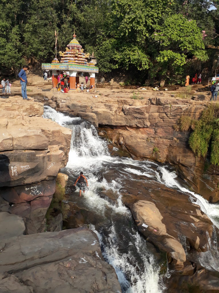
The northern watershed feeds numerous rivers, but the most significant in terms of volume and relevance are the big four that comprise the Ganges, Brahmaputra, Indus (a small part of which flows through India) and Mahanadi -one of the most important rivers of central India and Orissa. Unfortunately, this river is associated with wanton destruction. While the Mahanadi continues to be infamous for its annual floods, its gory association with the Kalinga war has tainted it eternally. So distraught was Emperor Ashoka by the carnage, that he embraced Buddhism in search of consolation.
 The river, once renowned for its legendary span has been reduced to a narrow rivulet in its middle course due to large dams and sedimentation. In the dry season, navigating the shallow Mahanadi by boat is difficult and one can safely walk across its fords. The silting also makes the delta exceptionally fertile. If sufficient resources were committed to the estuarine region of the Mahanadi, Orissa would be one of the richest states in eastern India.
The Mahanadi that is otherwise timid and impotent proves its might during the monsoon. The river has an estimated drainage area of 82,000 sq km and plays a primary role in the agrarian economy of the region. The Tel (a tributary of the Mahanadi) and the Mahanadi basins in the Sambalpur and Bolangir districts, together with the Brahmani and Baitarani basins, constitute one of the most fertile regions of India. The area it irrigates is so vast that it has been adjudged the second-largest wetland in Southeast Asia. The Mahanadi that discharges only 40 cubic meters of water per second in the dry months (often leading to drought-like conditions) carries 1, 17,000 cubic meters in the rainy season. If not for the Hirakud Dam near Sambalpur and the earthen barrage at Naraj, the destruction due to flooding in the middle and lower reaches of the river would be enormous.
The literal meaning of ‘Mahanadi’ is ‘Great River’ and at almost 900 km, it is no less than its name suggests. It is the only major northern river that lacks a perennial snow-fed source. Its mythical source which is also its point of origin is a hillock in the wild, mountainous region of Bastar in the Sihawadistrict of Chhattisgarh (40 km south-east of Raipur).
The origin of the Mahanadi is attributed to an interesting legend. In the distant past, all the sages of this region decided to Visit the Mahakumbh for a holy dip. Maharishi Shringi, a famous sage who was also supposed to join the pilgrimage was meditating at the time and could not be roused. After waiting for a few days, the other sages decided to continue their pilgrimage without him but decided to bring him a gift of holy water. When they returned, the Maharishi was still in a deep trance. Not wanting to disturb him, the sages filled his kamandalam with sacred water before returning to their respective hermitages. When the Maharishi finally ended his meditation, he wanted to stretch. By a careless stroke of his hand, some water from the kamandalam spilled onto the ground and began to flow in an eastwardly direction. This stream eventually became a river, which came to be known as the Mahanadi.
The Mahanadi’s geographical origins are also quite obscure. Atop a hillock in the Sihawa district of Chhattisgarh, a hermitage associated with Maharishi Shringi exists alongside the feeble proof of the river’s mythical origin. A tiny well, the circumference of which is less than a foot, is alleged to be the source of the river and the resident hermit of the ashram happily conforms to this.
The Mahanadi disappears underground here, before emerging again as a small stream that flows through the eastern parts of Chhattisgarh. Its first big tributary, the Seonath, is above the town of Seonarayan. It continues to flow eastward, gradually increasing in volume as more tributaries join it from the hill ranges between Chhota Nagpur and Sambalpur. The river enters Orissa at Hirakud (near Sambalpur) where it is dammed. At Padampur, it earns South and struggles past huge boulders on its way towards Sonepur. From here, it cuts through the hills, before descending into the lovely Satkosia Gorge at Tikarpara. This 22 km gorge flanked by forested slopes is famous for its cascading mountain streams and rapids and is popular with wildlife enthusiasts. The river runs through a thick deciduous forest that supports a variety of flora and fauna; a crocodile breeding center has been established1 here to reintroduce the Gharial into the Mahanadi’s riverine ecosystem.
From Tikarpara, the river flows towards the city of Cuttack that is flanked by the Mahanadi and its tributary, the Kathajodi. Cuttack was established in 989 AD and hence is also called the ‘millennium city. It was the capital of Orissa for almost ten centuries. In 1948, when the capital was shifted to Bhubaneswar, its importance remained undiluted and it retained its position as the administrative headquarters of Orissa. A walk along the banks of the Mahanadi unfolds Cuttack’s rich historical tapestry. The Barabati Fort built by the Ganga kings in the 14th century is now n ruins, but the brilliance of the highly decorative Orissan style Of architecture is still evident. If you travel downstream, you can see the stone revetment that was constructed in the 11th century to protect the city from floods and the stone barrage at Narai: both continue to serve their purpose.
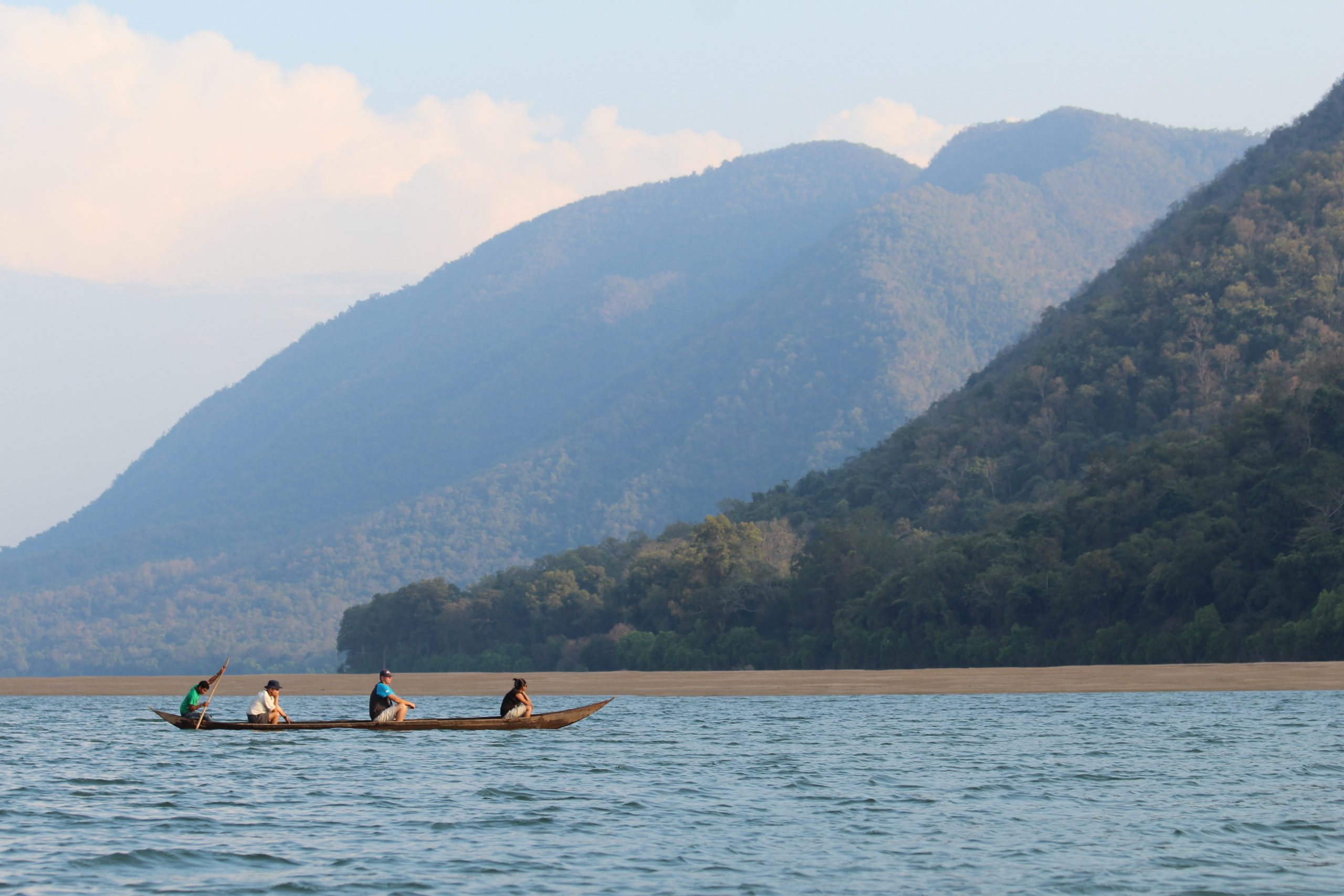 The Mahanadi continues its journey through Orissa before it disembogues into the Bay of Bengal at a place called ‘False Point’, which has a rather peculiar relationship with ill-fortune. The position of False Point was considered ideal for trade, and efforts had been made to develop it into a seaport where ocean-bound steamers could dock. A harbor was built here about two hundred years ago. In 1815, a violent storm not only destroyed the port but also claimed several lives. The project was abandoned and today, Paradip near False Point serves as Orissa’s primary seaport. Although the legend of its origin is Puranic in nature, the Mahanadi’s diminutive religious connection has meant that very few festivals are associated with the river itself. While a sacred dip on the auspicious occasion of Mahashivratri is observed throughout the region, the only other noteworthy river festival is the Baliyatra, which means a journey to Bali’. It marks the day when Sadhabas (Oriya mariners) set sail to Bali, Java, Sumatra, Borneo, and Sri Lanka for purposes of trade and cultural expansion. The festival is celebrated during Kartik Purnima (October November) for five days just before the full moon. These traders sailed in large vessels called biotas; therefore, the festival is also known as Boita Bandana Utsav (festival of boats). To recapitulate this ancient tradition, most port towns in this belt observe an elaborate ceremony in which boats are worshipped. Seafarers and boatmen have always believed in omens and water deities to help them through their journeys. But there were also ancient navigational aids that often came to their rescue. Just south-west of Sambalpur, on the bank of the Mahanadi, is one such place that played an important role in ancient river navigation. Called a lighthouse without light’ the Ghanteshwari Temple is famous for the thousands of bells that are hung in long rows on every available branch and fence. Whenever the wind blew, the bells warned boatmen of the treacherous spot near the temple, where three streams of the Mahanadi met, creating a giant whirlpool. Following the construction of the Hirakud Dam, this stretch does not pose any further danger.
In striking contrast to the other northern rivers, the Mahanadi has been rather shy of religious association, but specimens of religious architecture can still be found in the temple towns of Rajim, Sirpur (Chhattisgarh) and Sambalpur. Of these, Huma near Sambalpur is famous for its leaning shrines. Nobody knows the true reason behind this, but there is an interesting myth about the temple’s origins. The worship of Shiva (the main deity) is said to have been initiated by a cowherd. One of his cows would go into the jungle every day and return without milk. The bewildered cowherd followed the cow one day and was amazed to find the animal standing over black rock, spraying it with milk. It did not take this cowherd long to realize that the rock was a Shivalinga and he began to worship it every day. It is alleged that the original temple was built around this Shivalinga. The tame Kodo fish that live in shallow pools along the river eat out of the pilgrims’ hands and many locals make their living selling fish feed. These fish are never caught or eaten as they are believed to be sacred.
After Sambalpur and Cuttack, the river flows through picturesque agricultural villages before entering Paradip, where the entire scenery changes. Chimneys of petrochemical units and dock cranes rise from the landscape like alien figures. The fresh air of rural India is replaced by a thick blanket of chemical smog that hangs low. Although a part of Paradip is highly developed, the other side comprises of virgin beaches. Charming fishing villages with their traditional way of life compete with the burgeoning needs of an industrialized township. Urbanization is gradually intruding into their lifestyle and effluents are slowly poisoning the sea on which this fisherfolk depends. Brave men in their tiny fishing boats are often seen battling the elements. With only a prayer on their lips to guide them home and the fond hope of a good catch, they have preserved their tradition for centuries. However, this might soon be a thing of the past, for if the levels of pollution increase, this community might become extinct. If the carcasses of giant sea turtles and the drastic fall in catches are any indication, the first signs of impending doom are already quite visible.

The Krishna – The Krishnaveni Of India
August 28, 2020 in Andhra Pradesh, Karnataka, Maharashtra, Telangana
In the quaint hill station of Old Mahabaleshwar on the slopes of the Western Ghats is a shrine dedicated to Shiva. The Adi Mahadeva Temple appears unassuming from the outside; however, as soon as you enter it, a profoundly interesting sight greets you. The Krishna river that rises in these hills flows through subterranean passages and exits through the snout of a stone Nandi (celestial bull). The water that drains into a tank in the inner courtyard of the temple disappears underground once again until it reaches the edge of the Mahabaleshwar Plateau. Here it descends into the Krishna/Koyna Valley as a series of waterfalls.
 This temple is considered the mythical source of the Krishna. With such proximity to its geographical origins, this is not surprising. Although the river emerges from the snout as a thin stream, it becomes a behemoth of many tributaries, which merge with it along its course, making it one of the largest river systems in the country. The 1300 km long Krishna is the lifeline of Maharashtra, Karnataka, and Andhra Pradesh. For centuries, it has been a witness to the rise and fall of various kingdoms in the Deccan and South India.
There is a fascinating legend associated with the origin of this river. It is believed that the river is an incarnation of the Hindu god Vishnu who was turned into a river due to a curse. Enamored by goddess Parvati’s beauty, Vishnu could not resist the temptation of seducing her and magically took the form of her husband Shiva. Upon discovering his true origins, Parvati cursed him-as a consequence, he was transformed into a female river. Strangely, Krishna’s tributaries the Vena and Koyna are believed to incarnate of Shiva and Brahma respectively.
 Due to its association with the Hindu Trinity of Brahma, Vishnu, and Shiva, several centers of pilgrimage have flourished along the banks of the Krishna and its tributaries. However, these are mere relics of its association with Hinduism. To see the real power that it holds over those who believe in its sanctity, one should participate in the Krishna Pushkaram.
An interesting myth is associated with this festival. Tundila, a devout Brahmin priest performed severe austerities to gain the favors of Shiva and finally won the right to serve as one of his principal companions. Shiva who was then in his riverine form (one of his eight incarnations) was perplexed about choosing a mortal as his companion, as the priest would certainly drown in his company. Instead, he decided to make Tundila the caretaker of all the water bodies in the universe. The priest earned the title of Pushkara’ (one who caters to the needs of the world).
Pushkara was very judicious in performing his duties; however, he was entangled in a celestial controversy. Brahma (the creator) desperately needed water to realize his dream of a perfect universe. As Pushkara was the sole guardian of all the water resources, Brahma had to persuade Shiva to let him live in his kamandalam, which Pushkara eventually agreed to. However, this is hardly the end of the controversy. The Vedic god Brihaspati also wanted to share the responsibility of creation. Therefore, he too requested Shiva to place Pushkara under his command. Although his wish was granted, Pushkara refused to oblige, as he did not want to leave Brahma’s side. He put forth the condition that if he were to help Brihaspati, Brahma would have to accompany him.
 Brahma resolved this delicate situation with ease. It was decided that Pushkara would stay with Brihaspati for a length of two muhurthams, (an auspicious time) for 12 days when the latter was entering a particular zodiac sign and 12 days when he was exiting it. Brahma, accompanied by all the other gods, would sanctify the holy river, which Brihaspati was visiting during this stipulated period. In this way, Pushkara could serve both Brahma and Brihaspati.
During the Pushkarams, devotees undertake purification and Brihaspati. rituals that usually conclude with a holy dip. They also pay homage to their departed ancestors in an elaborate shradh ceremony in a bid to appease their spirits.
Another famous river festival on the Krishna coincides with the end of the Dusshera festivities. The Bhavani Diksha involves a lengthy 41-day prelude to the main event that eventually unfolds at Durga Ghat in Vijayawada. Devotees of Kanaka Durga (patron deity of Vijayawada) live like ascetics and perform various Vedic rituals during this period. On the last day of the festival, thousands of pilgrims in flaming red garments throng to the banks of the Krishna for a holy dip.
 Rivers have played a central role in Hindu belief and the Indian context, it is impossible to disassociate religion from the rivers. However, we have to realize that the rivers have supported civilizations long before the concept of religion emerged. There are numerous historical sites along Krishna’s course. Satara, which lies below Mahabaleshwar, is most famous for its association with the Marathas and their epic battles against the last Mughal emperor Aurangzeb. Its pre-medieval history dates back to the rule of the Gupta Empire followed by the reign of the Satvahanas. The Deccan style temples on the banks of the Krishna (at Satara) are comparatively recent.
Jamkhandi in Northern Karnataka is renowned for its Chalukyan monuments, which include the 1000-year-old temple of Jambukeshwar (an incarnation of Shiva). Srisailam in the Kurnool district of Andhra Pradesh is one of the twelve Jyotirlinga shrines of Shiva while Nandikonda and Amravati have numerous Buddhist relics. Vijayawada, which has emerged as the epicenter of Andhra culture, has been historically associated with the Chalukyas of Badami.
The Krishna, which has supported numerous civilizations over the centuries, continues to sustain a vast population. With its 35 tributaries, it irrigates a large agricultural zone, making the region naturally attractive to commercial exploitation. While agriculture has always been the primary economic activity, large-scale industrialization is a reality that the people of the Krishna Valley have to concede with. Both farming and industry depend on the availability of land and water. This is where the conflict begins: the acquisition of agricultural land for the industry is one of the most debatable issues today. The lax laws on the treatment and discharge of industrial effluents intensify the problem. The co-existence of industry and agriculture has led to disastrous results in the past. Large tracts of arable land along the Krishna basin have been rendered unfit for agricultural use due to untreated industrial discharge and other pollutants.
While the population has been rising rapidly over the years, the amount of water available has remained constant. In areas where the aquifer is depleted faster than its annual rate of replenishment, we have less water than we had a decade ago. Adding to this problem is the fact that most of our rivers are also used as drainage systems for domestic and industrial waste. The sheer combined volume of the Krishna and its tributaries only means that this problem is multiplied to uncontrollable levels.
The Krishna river system receives effluents and wastewater from several large cities, which include Pune, Satara, Kolhapur, Hyderabad, Kurnool, and Vijayawada among others. More than 500 important industrial units operate from the Krishna basin, 200 of which are large-scale industries.
To cite an example of the environmental damage caused by industríal effluents, one has to visit Dharwad on the banks of the Tungabhadra, an important tributary of the Krishna. Here two units of the Gwalior Rayon Silk Manufacturing Company Ltd (Grasim) generate approximately 33,000 cubic meters of effluents.
Villagers downstream were affected by the increased level of pollution as soon as the plant was commissioned, but the worst hit was the fisherfolk. Fish stocks were nearly wiped out from the lower reaches of the Tungabhadra. While numerous committees were set up to look into the grievances of these fisherfolk, hardly anything came out of it. In 2002, after a prolonged legal battle that lasted eight years, these fishermen received a meager individual compensation of two thousand rupees. Today, completely disheartened, many of them have migrated to the cities in search of livelihood.
The people of the Krishna Basin also have to contend with the unpredictable nature of the river and its tributaries. In October 2009, floods replaced drought-like conditions in southern India, marooning more than 350 villages and leaving millions homeless. On October 6, 2009, the Press Trust of India (PT) reported that the Krishna River set a record in flood discharge at the Prakasam Barrage, surpassing the previous record from 1903, when there were no dams across the river.
 Today, the same issues that affect the other rivers of the region plague the Krishna and its tributaries. The reality of a disappearing delta is no longer a fictional notion. Weather patterns are becoming harsher due to global warming. The scenario of extreme climatic changes, which would radically alter the face of the globe, is no longer a myth. Machalipatanam, where the Krishna meets the sea was once a flourishing port town. It is yet to recover from the aftermath of the tsunami, which struck the Andhra coast in 2004. If the question of sustainability is not addressed, India’s rain-fed rivers may not be able to support future generations.
The Godavari – India’s Second Longest River
August 28, 2020 in Andhra Pradesh, Chhattisgarh, Maharashtra, Odisha
Below a stunted hill in the Western Ghats just north of Nasik, the quaint village of Trimbakesh embraces a few relics of Hindu religious architecture and a seemingly insignificant temple tank. This tank, not larger than a village pond is the mythical source of the Godavari. Many devotees are of the firm opinion that this is the singular source of the river. However, the watershed of the almost 1500 km long Godavari comprises of both the Eastern and Western Ghats.
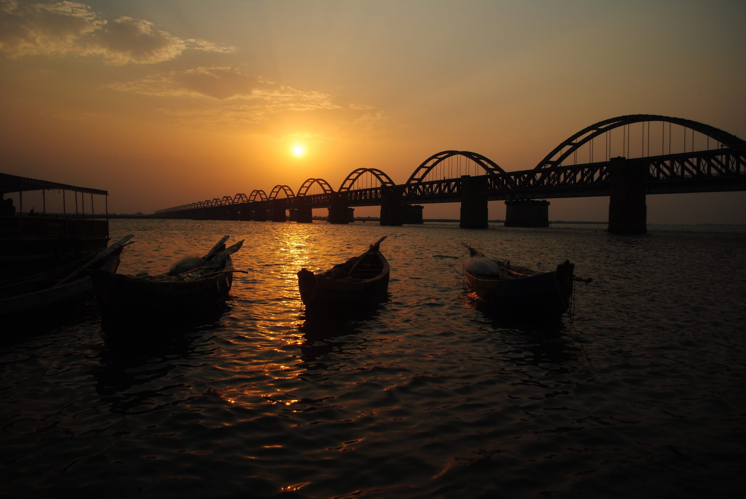 The river starts its gentle descent on the slopes of the Brahmagiri hills above Trimbakesh and flows east across the Deccan Plateau through Maharashtra. It enters Andhra Pradesh in the Nizamabad district and continues its journey until it meets the Bay of Bengal through two separate channels in the Andhra delta.
In India, water bodies are greatly venerated and the Godavari is no different. All along its course, there are numerous places of pilgrimage that are redolent with many legends. One of these pertains to its mythological origins. Sage Gautama resided in a hermitage on the Brahmagiri Hills with his wife Ahalya. By his devotion to the chief of gods, he received as a boon, a certain bottomless well that yielded an inexhaustible supply of food grain. The other sages, jealous of his fortune, connived and arranged for a cow to enter his granary, and they caused it to die as Gautama tried to chase it away with a bundle of grass. The sage was inconsolable; the death of a cow at the hands of a Brahmin was an unthinkable act. The only way his sin would be absolved was if Ganga could be persuaded to visit his hermitage. However, this was not easy, as only Shiva possessed the power to convince her.
Gautama performed severe austerities to appease Shiva, who finally conceded to his prayers. Ganga then came down as the Godavari along with Shiva, who took the form of Tryambaka. The temple at Trimbakesh is dedicated to this legend and is one of the twelve Jyotirlinga shrines of Shiva. This is perhaps why the locals here refer to the Godavari as the Gautami Ganga. Both Trimbakeshwar and Nasik (30 km southeast) are venues for the Kumbh Mela, the largest religious gathering in the world.
While most Indian rivers are linked with Hinduism, the Godavari represents the secular face of India. Paithan, which is located 56 km south of Aurangabad, is associated with the Bhakti Movement and Jainism. It is believed that whoever visits the Digambar Jain Atishay Kshetra will have their wishes fulfilled. Paithan is also famous for its handloom silk saris (Paithani) which is the traditional bridal attire in Maharashtra. The Jayakwadi Dam near Paithan, which spans the Godavari, falls on the migratory path of Siberian Cranes and is popular with nature lovers.
Nanded, which is approximately 270 km Southwest of Aurangabad, is renowned for its connection with Sikhism. In 1708, following the death of the Mughal monarch Aurangzeb, Guru Gobind Singh, the tenth spiritual leader of the Sikhs came here and proclaimed himself the last living.guru. Takhat Sachkhand Sri Hazoor Sahib, where he breathed his last, is the most important Sikh shrine in Nanded. Although this draws the maximum number of Sikh pilgrims, there are numerous other gurudwaras and charitable schools for Sikh children along the Godavari.
From Nanded, the river meanders towards Vishnupuri, a village (10 km away) famous for the Shiva temple of Kaleshwar and the Vishnupuri Dam. The latter is one of the largest lift irrigation projects in Asia.
 The Godavari continues its journey through a series of agricultural barrages before it enters the Nizamabad district in Andhra Pradesh. About 40 km from the district headquarters (of the same name) is the temple town of Basar. This town’s claim to fame is its association with Saraswati, the Hindu goddess of knowledge. A Chalukyan era temple dedicated to her towers above the otherwise mundane landscape. Many pilgrims come here to perform the akshaa abhyasam, a ceremony in which parents seek the goddess’ blessing before children commence their formal education. This ritual begins and concludes with a dip in the Godavari. A statue of the goddess at the entrance of the ghats attracts both pilgrims and hawkers and makes walking rather difficult. The boats by the water’s edge provide a perfect respite from this chaos.
Dharmapuri, approximately 100 km from Nizamabad, has one of the largest settlements of Vedic Brahmins in Andhra Pradesh. Families here have zealously managed to cling on to their traditions and some still maintain the practice of reading Vedic hymns from ancient Talapatra scriptures. The people of Dharmapuri have a peculiar dialect, which is unique to this township. Temples of various sizes, dedicated to virtually every god in the Hindu pantheon can be found here. Amongst them is the rare temple of Lord Dattatreya (Brahma’s son).
As the Godavari continues its journey towards the delta, it passes through the temple town of Bhadrachalam, which is intimately linked with the life of Saint Bhadrachala Ramadasa. Known as Gopanna in his times, he was the tehsildar of Bhadrachalam during the latter part of the 17th century. Convicted of misappropriating funds from the government treasury to build a temple, he was imprisoned in the Golconda Fort. It is said that Rama and Lakshmana (protagonists of the Hindu epic Ramayana) appeared in disguise at the sultan’s court and repaid the entire amount in gold. The king, realizing that Ramadasa was no ordinary human being, freed him immediately. The singing saint who was part of the reformist Bhakti Movement has composed some of the most melodious Ram bhajans in Telegu. As you climb the temple steps, the air still resonates with the melody of his devotional songs.
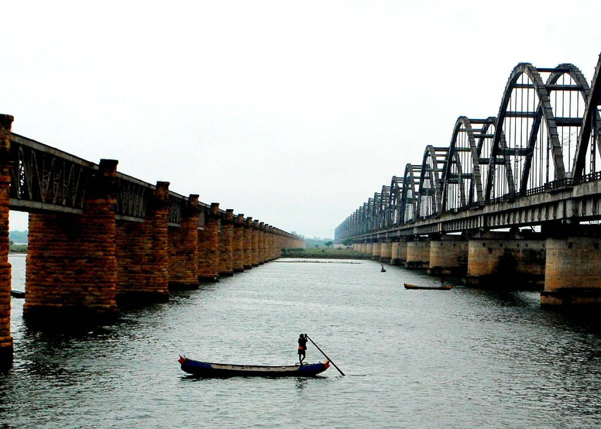
Just before the river enters the delta, it flows through two prominent centers of pilgrimage, Pattiseema, and Rajahmundry. While the former is famous for its association with Shiva, Rajahmundry, 18 km away is the site of the Godavari Pushkaram, a river festival celebrated once in 12 years.
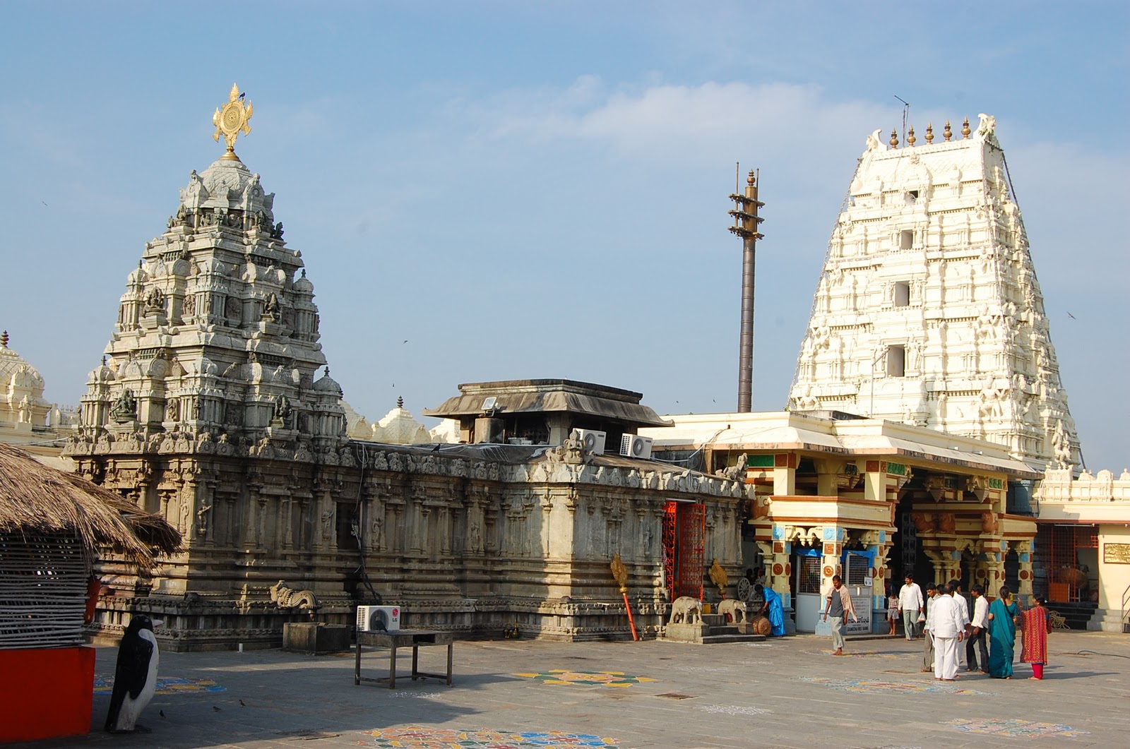
 The Veerabhadra Swamy Temple dedicated to Shiva is sited on a hillock in the middle of the Godavari and is one of the most visited Shaivite shrines in Andhra Pradesh. There is a legend associated with the temple’s origin. Shiva, aghast at seeing his wife being reduced to ashes in the yajna (sacrificial pyre) performed by his father-in-law Daksha Prajapati created Veerabhadra to avenge this insult. According to popular belief, Veerabhadra was born out of a lock of Shiva’s hair that fell during his dance of destruction (Tandav Nritya). After destroying the yajna, Veerabhadra slew Daksha and threw the bloody sword into the Godavari. Although Daksha had committed the unthinkable, he was no mere mortal. He begged for forgiveness as his soul left for its celestial realm, and the benevolent Shiva forgave him. The place where he was felled bore a Shivaling, while a hillock emerged at the spot where Veerabhadra threw the sword. Today, this site has minor shrines dedicated to a plethora of deities. The festival of Mahashivratri (the great night of Shiva) is celebrated with great pomp and thousands of pilgrims throng to the hillock to offer prayers at Shiva’s altar.
Every twelve years, around 30 million pilgrims take a holy dip in the Godavari during the Pushkaram festival. Many of them follow the river from Kaleswaram in Andhra Pradesh (Karimnagar district) to Antarvedi (East Godavari district) where it joins the Bay of Bengal. However, Rajahmundry, the seat of Telegu culture and literature, is where most of the devotees congregate. The star attraction here is the giant-sized shivaling. Water from the Godavari is channeled through a spout above the lingam and pilgrims bathe in its shower.
Pushkarams have a profound spiritual significance for Hindus, who have a tradition of worshipping rivers. They believe that a dip during this auspicious period will invest one with providence.
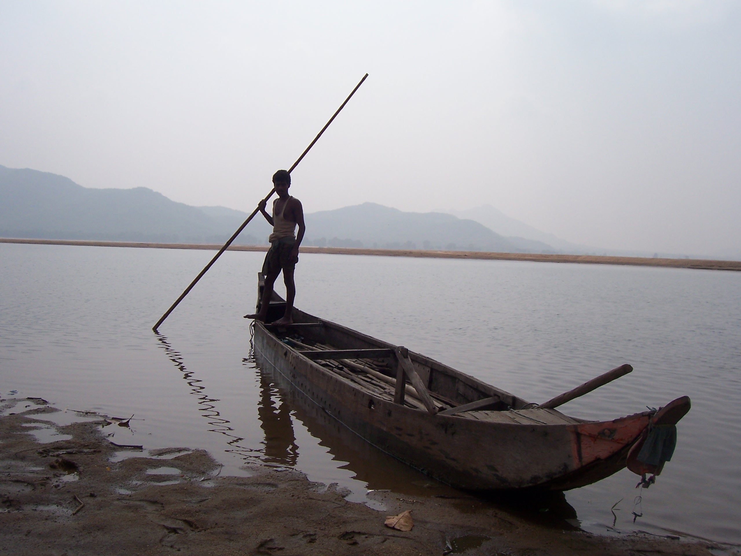 Today, the biggest challenge faced by deltas along the east coast is erosion and the Godavari delta can lose up to 23 percent of its landmass by 2050. Groundwater pumping is a major cause of subsidence and storms are a constant threat to a region that has few coastal defenses. While deltas are naturally vulnerable because they form in low-lying coastal regions, human activities add to the peril. The rate of retreat is directly related to population and economic exploitation. Dams and canals upstream also and contribute to the problem, as they prevent sediment from reaching the delta. The Krishna Godavari basin is rich in fossil fuels. Petroleum extraction from beneath the delta is causing the sediment-starved land to sink further. This is also responsible for the waterline along the deltaic region to rise faster than average global sea levels. If this trend continues, agriculture may not be economically viable here in the future.
Pollution, over-population, and unsustainable exploitation of resources are slowly taking a toll on the Godavari. The question then is, who should take guardianship of the river? Until the people of the Krishna-Godavari basin introspect and harmonize their relationship with nature, the Godavari will continue to suffer.

Travel The Ganges
August 27, 2020 in Bihar, Chhattisgarh, Delhi, Haryana, Himachal Pradesh, Jharkhand, Madhya Pradesh, Rajasthan, Uttar Pradesh, Uttarakhand, West Bengal
The Ganges has the indisputable reputation of being India’s holiest river. India is the birthplace of Hinduism and the river provides the elixir for the undying devotion of many generations of Hindus. Over many millennia, pilgrims have subscribed to the belief that bathing in the Ganges absolves sin and circumvents the process of rebirth.

The Puranas include many tales about the Ganges and its origins. King Shantanu, an ancestor of the Pandavas (heroes of the Mahabharata) chanced upon Ganga in her mortal form. Smitten by her beauty, he instantly asked for her hand in marriage. The river goddess agreed, but put forth a condition: Shantanu could never question her actions, however abhorrent they might seem. If he did, she would be compelled to leave him. The king and his queen lived happily together and soon a son was born to them. But to Shantanu’s horror, Ganga carried him to the river and drowned him. Shantanu was aghast but did not intervene until the same fate befell six more of his children. When the eighth child was born, the grief-stricken king could not contain himself any longer and demanded an explanation. Before Ganga left him, she identified herself and told the king that his sons were Vasus (divine beings) who were born as mortals due to a curse. By drowning them, she had liberated their doomed souls. As her action was interrupted, the eighth child would have to live as a mortal on earth. She then decided to take their surviving son Devavrata with a promise that he would return to Shantanu as heir apparent at the age of sixteen. This child, who later came to be known as Bhishma, played a pivotal role in the Mahabharata.

The most popular legend about Ganga’s origin revolves around King Sagar, his sixty thousand sons, and his sympathetic scion Bhagiratha. King Sagar who ruled Ayodhya was an ancestor of Rama, the protagonist of the Hindu epic Ramayana. He is believed to have successfully performed the Ashwamedha Yajna (horse sacrifice) ninety-nine times.
Indra, the king of gods was envious of King Sagar’s success. Using his magical powers, he stole the sacrificial stallion and hid it in the hermitage of Kapil Muni. The sage who was in a meditative trance was oblivious to this plot. The sixty-thousand sons of Sagar managed to trace the horse and holding the sage responsible for the abduction, assaulted him. The enraged sage consigned the princes to ashes with his glare.

Many years later, when King Bhagiratha learned about the plight of his ancestors, he requested the sage to grant them salvation. Although the sage gave him a patient hearing, he regretted his inability to reverse the curse and suggested that Bhagiratha prays to Ganga, as only her touch could liberate their souls. The king observed a protracted penance in the fond hope that Brahma would let Ganga leave her heavenly abode and descend to earth. Pleased with his devotion, Brahma granted his wish but warned him that only Shiva could sustain the power of her descent. Thus began another arduous penance by which the persuasive king managed to appease Shiva, who let Ganga flow through his matted locks as she descended to earth. When Ganga touched the ashes of Bhagiratha’s ancestors, their souls were freed and they ascended to heaven singing his praises.

While Ganga’s mythical descent is attributed to the prolonged penances of King Bhagiratha, her geographical birth that goes back at least 50 million years coincides with the formation of the Himalayas, where she starts her journey. High above the foothills of the western Himalayas, below the Swargarohini Range in Uttaranchal, a sinuous trail of rock and ice meanders slowly towards Gomukh, the glacial snout where the Ganga begins her earthly descent. However, this is not a solitary source. The alpine meadow of Tapovan above the Gangotri glacier has numerous feeder streams that join the glacial melt. At an altitude of almost 16,000 feet, the meadow supports an astonishing diversity of flora and fauna. Hundreds of Ibex and Ghural graze undisturbed here. This is also the domain of the elusive Snow Leopard. The fact that this region is inaccessible to most tourists has ensured its pristine habitat.

At its source, the river is known as Bhagirathi. It joins the Alaknanda River at Devaprayag to form the Ganges. From Gomukh, the river cuts through a deep gorge, progressively descending from an altitude of 15,000 feet to 10,000 feet before flowing past the town of Gangotri. Although many small streams drain into the Ganges, its six main tributaries and their five confluences have tremendous religious importance. The Alaknanda meets the Dhauliganga at Vishnuprayag: the Mandakini at Nandprayag; the Pindar at Karnaprayag; the Mandakini at Rudraprayag and finally the Bhagirathi at Devprayag to form the headwaters of the Ganges. The Bhagirathi that rises at Gomukh is the source stream of the Ganges and is its most important tributary.
The Ghats of Varanasi
The Ghats on the riverfront provides a backdrop for an unparalleled human drama that unfolds at the break of dawn involving thousands who come here to bathe. The silence of the waning night is shattered by hymns. Smoke from funeral pyres and incense sticks hangs about the air like an inescapable mantle. The pundit and pilgrim try to outwit each other, but the pundit always wins. Mimes walk past dressed as gods; the many Hanumans, Shivas and Ramas often squabble over territorial rights. When the sun hoists itself into the zenith, the ghats become quieter. The activities along them resume towards the end of the day when the aartis commence. Electric lamps compete with the countless diyas that are set afloat in the Ganges. If the oil lamps manage to stay afloat, it is considered a good omen.
 Musicians vie for attention and each group tries to drown the sounds of the other. The chants reach a crescendo and in a hypnotic trance, pilgrims sway to the music. Then as the reverberations fade, the crowd disperses and an aphotic hush descends on the ghats. The silence of the night is broken only by the occasional song of a boatman -the voice of the Ganges.
In the 18th century, the Gorkha chieftain Amar Singh Thapa constructed a shrine dedicated to Ganga at Gangotri. Like any other center of pilgrimage, the temple is the node around which a disorganized town has proliferated. Gangotri was connected to the plains by a fully-motorable road only a couple of decades ago; before this, pilgrims had to make a long and often dangerous trek to reach the shrine. A thunderous Bhagirathi snakes past the broken mountain landscape before entering a woefully narrow gorge known as Gaurikund. From here it begins its gradual descent into the plains. This is one of the four sites of the Char Dham pilgrimage circuit. Every year, thousands of pilgrims throng to the site between May and October. By November, Gangotri is covered with snow, and it is believed that the Goddess retreats to Mukhba, her winter abode (12 km downstream).
The next important town along the river, Uttarkashi is also the starting point for pilgrimages to the hill shrines of Uttaranchal.
Situated at an average elevation of 3800 ft, this picturesque town is sited along the edges of a ravine gouged out by the Bhagirathi. A possessed suspension bridge that sways, groans, and trembles connect the two sides. The temples, bathing ghats, and holy men are concentrated on the eastern bank of the river. The Bhagirathi that is relatively untainted in the mountains, gets its first taste of pollutants in Uttarkashi. While it is not very apparent from a distance, the sheer volume of garbage dumped along the river is horrifying. But the pilgrims do not seem to mind, and the civic authorities don’t care and life along the ghats goes on as usual. The Ganges flows past the towns of Rishikesh and Haridwar before entering the plains. The first noticeable thing about Rishikesh is its serenity and absolute unhurried way of life. Nestled amidst the Shivalik Range, the town is quieter and cleaner than its more populous twin Haridwar. Back in the ’60s, it gained instant but fleeting fame as the place where the Beatles came to be with their guru, Maharishi Mahesh Yogi. In the 70s, it was the 70s, a popular destination for the ‘flower children’. Today, other than being an excellent place for the study of Hinduism and yoga, Rishikesh also attracts white water, rafting enthusiasts.
