

Member Type Contributor


Flora and Fauna
August 27, 2020 in Wildlife & Nature
Human beings are perhaps the first species to be prolific enough to have threatened their existence by destroying the very ecosystem that supports them. The very importance of rivers as a source of potable water is apparent; so is the fact that most of them are so polluted that they can barely sustain life.
 While the effect of river pollution on human beings has become apparent in the last few decades, the principal sufferers are the many living organisms that call the river their home. Today, several categories of fish are either extinct or endangered. The Gharial, which has been in existence for many hundreds of years, was once found in virtually every northern river system. Its range extended from the Indus in Pakistan to the Irrawaddy in Burma. However, this has now shrunk to a few small stretches in Northern India. The Mugger or Marsh crocodile that can grow up to a length of 18 feet once thrived in the Indian rivers. However, unregulated hunting in the 19th century brought the entire population to the brink of extinction. By the 1970s, awareness of the plight of crocodiles fuelled conservation efforts and partially revived their numbers in the wild. Habitat destruction is the main threat causing a 20 percent decline in numbers, and today the species is considered vulnerable.
One of the rarest and most endangered mammals on earth can also be found in India’s rivers. The Ganges River Dolphin is India’s National Aquatic Animal. It is primarily found in the Ganges, the Brahmaputra, and their tributaries in India, Bangladesh, and Nepal. These fascinating mammals, which are almost blind, hunt, and navigate by the use of echolocation. They have been adversely affected by human use of the river systems. Entanglement in fishing nets causes significant damage to their numbers. Despite their endangered status, many dolphins are still trapped each year for their oil and meat, which are used as liniment, aphrodisiac, and bait for catfish. Large dams and irrigation canals have lowered water levels in the main river systems throughout India. Perhaps the most significant issue is that the dams result in the segregation of the dolphin population and a narrowed gene pool in which dolphins can breed. Poisoning of the water supply from industrial and agricultural chemicals has also contributed to their decline. There are currently only three subspecies of river dolphins considered capable of long-term survival if protected.
The Ganges Shark is another rare inhabitant of the Gangetic river system. It is largely restricted to the rivers of Eastern and Northeastern India, particularly the Hooghly in West Bengal, the Ganges, Brahmaputra, and the Mahanadi in Orissa. Bengalis call it Baagh Maach, which translates into tiger fish. It is typically found in the mid to lower reaches of a river. Although very little is known about these elusive sharks, they are believed to be scavengers. Most of the Eastern and Northeastern Indian rivers are prone to flooding which causes widespread loss of animal and human lives. These sharks scavenge the carcasses and help keep the river clean, and are thus a vital part of the river’s ecosystem. Like the freshwater shark, turtles too play an important scavenging role. Hundreds of Snapping Turtles were released into the Gangetic river system in the recent past in an attempt to clean it.
Although the fish populations have declined steadily over the years due to overfishing and pollution, the Indian river systems still support a passive fishing industry. The famed Hilsa and Tangra (catfish) that are a quintessential part of Bengali cuisine are bred mostly in fish farms today. Similarly, the reduction in the numbers of other economically important fish like Carp and freshwater shrimp has also been observed. However, the upper reaches of the trans-Himalayan region continue to support a healthy population of at least 218 species of fish. The most important among these are Mahseer, Silver Carp, Salmon, Tortor, and Brown Trout. Although many organisms are restricted to the freshwater in rivers, some, such as Salmon and Hilsa, can also adapt to seawater.
Other than sustaining their ecosystem, rivers are also responsible for draining large tracts of land and nurturing forests and grasslands. The Western Ghats that form one of the three principal watersheds of India is amongst the world’s ten most important biodiversity hotspots and shelters over 5000 varieties of flowering plants, 508 avian species, and over 150 species of mammals and amphibians. At least 325 globally threatened species are found here. Similarly, the Brahmaputra nourishes the grasslands of Assam, which is home to another endangered mammal-the one-horned Indian Rhinoceros. For its size, the Kaziranga National Park supports the highest density of tigers in the world as well as significant herds of Elephant, Rhinoceros, and Swamp Deer.
Although mangrove forests are not part of a river system, they are found in the riverine deltas. India has some of the densest mangrove forests in the world, especially in the Ganges- Brahmaputra delta region. The Sunderbans is part of the vast Gangetic delta that stretches from West Bengal to the east coast of Bangladesh. In India, the Sunderbans encompass an almost impenetrable mangrove forest covering 4264 sq km. This area is one of the most fragile ecosystems on earth and supports Some of the world’s most endangered species. It is the last refuge of the Royal Bengal Tiger and the estuarine crocodile.
Today, poaching and global warming are its Today, biggest threats. Today, the ecology of the river and the secondary ecosystems it supports are under serious threat. If urgent steps are not taken to stem ecological degradation, our rivers may not be able to sustain any life in the future.

Floods and Flood Plains
August 27, 2020 in City Guide
A. flood is a consequence of many factors. The vagaries of nature and human avarice are equally responsible for the devastation caused by floods. In theory, flooding occurs when the volume of water within a water body exceeds the carrying capacity of its channel. When the embankment is inundated with this excessive volume of water, it cannot contain the flow and the resultant runoff flows into the surrounding areas. The devastation caused by floods depends on topography and the volume of overflow. The low-lying deltaic region of eastern India and Bangladesh is the most flood-prone areas in the world. India accounts for one-fifth of the global death toll due to floods and on average, about thirty million people are evacuated from the flood plains along the Bay of Bengal every year.

While floods cause immense destruction, they also deposit fertile soil in the lower reaches of the river. The deltas, which form due to the bifurcation of river channels are the most fertile zones of a country and support the densest levels of the population. In India, rivers like the Ganges and the Brahmaputra have the most extensive flood plains.
Migration is very visible in cities like Tezpur, Guwahati, and Jorhat where the movement from rural areas has led to an acute strain on infrastructure.
The Brahmaputra supports a vast ecosystem and the grasslands of Assam are famous for their wildlife, especially the iconic one-horned Rhinoceros that has been adopted as the state symbol. Goalpara and Kaziranga are two of Assam’s most famous wildlife sanctuaries. From Goalpara, the river meanders west towards Dhubri where it enters Bangladesh. This town is famous for its bamboo trade and floating markets. Traders from Meghalaya and Arunachal Pradesh float down the river on bamboo rafts, which they dismantle and sell here. Hundreds of these rafts tied along the river’s edge create beautiful abstract patterns.
The broad river then splits into two channels; the mainstream called the Jamuna in Bangladesh joins the Padma arm of the Ganges. Together, they eventually join the Ganges and Meghna rivers and their numerous distributaries to form the largest and the most fertile delta in the world, before flowing into the Bay of Bengal. The mangrove forests of the Sunderbans are home to a host of endangered species. It is also the last realm of the elusive Bengal Tiger. Rising sea levels due to global warming pose a major threat to the ecosystem of the region and many islands are now partially submerged. The floodplains are extensively cultivated both in India and Bangladesh. Other than agriculture, fishing plays an important role in the economy of both countries.

In the past, the Brahmaputra was largely isolated from pollution, but that is changing today. A growing population and accelerated industrialization have overwhelmed the river, increasing the threat to human health, as well as endangering many other species.
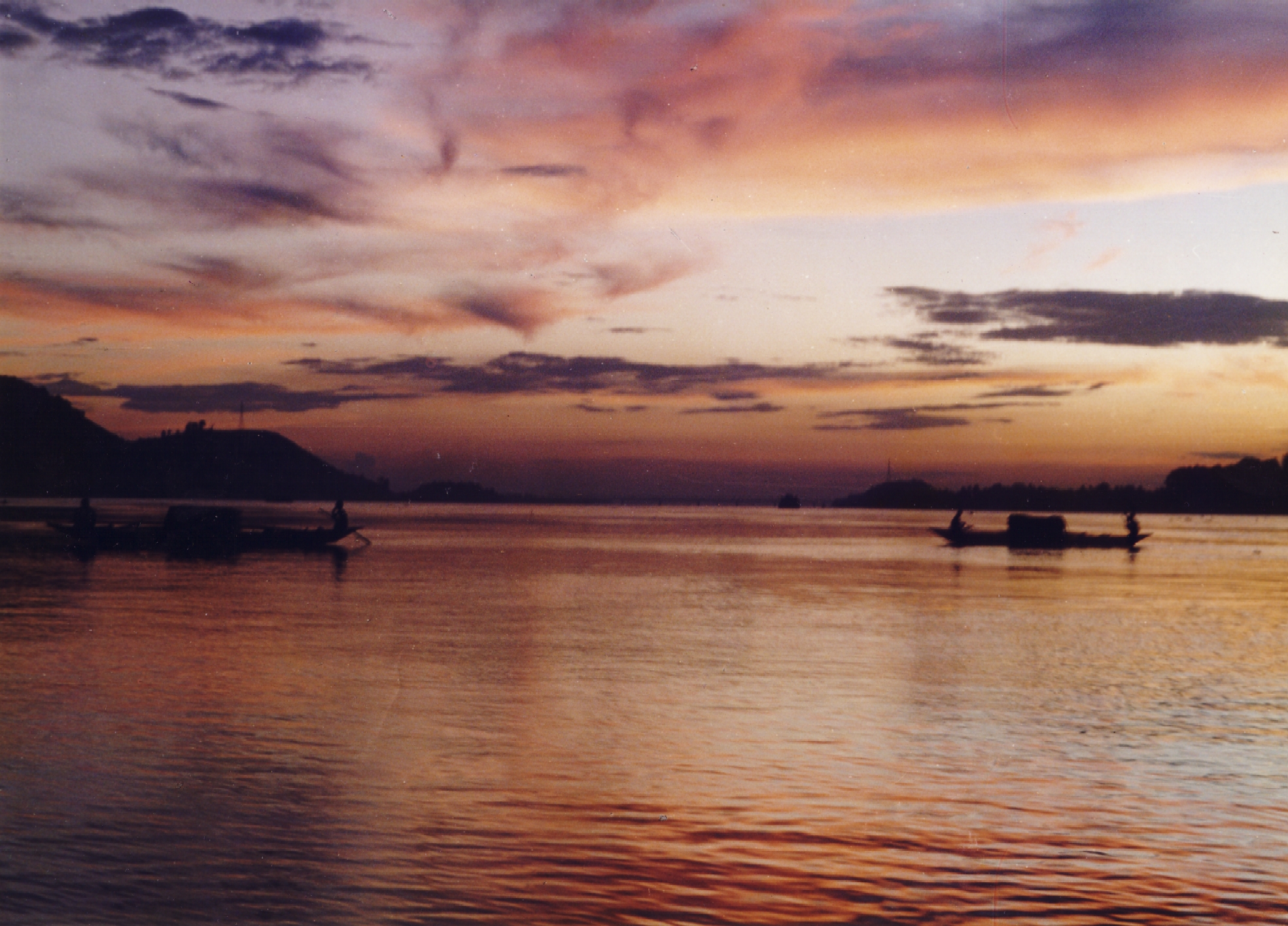
The Brahmaputra – Our Very Own Red River
August 27, 2020 in Arunachal Pradesh, Assam, Meghalaya, Nagaland, Sikkim, Wildlife & Nature
The Brahmaputra, the lifeline of northeast India is undoubtedly one of Asia’s most magnificent rivers. This river which is almost 3000 km long, is known by different names in the three countries it flows through (China, India, and Bangladesh). Its uniqueness also lies in the fact that it represents and bridges three major religions: Hinduism, Buddhism, and Islam, making it a virtual cultural consommé. Nothing can prepare the traveler for the vastness of this great water highway, where myriad channels ply through seemingly endless archipelagoes of sand.
The Brahmaputra is one of the few masculine rivers in India. This gender classification has resulted mainly from its sheer size and the strength of its currents, especially during the monsoon. In the tradition of Sanskrit literature, the sea is considered masculine while a river is usually feminine. In this context, it is important to note that Lauhitya (Brahmaputra) in ancient times was often referred to as a sea.
The origin of the Brahmaputra is associated with several legends. According to one story, Sage Shantanu and his wife took abode on Mount Gandhamadana. Brahma called upon the sage, who was away at the time gathering fruits and flowers in the forest. Brahma’s eyes fell on Amogha, the sage’s exquisitely beautiful wife who failed to recognize him. Enamored by her beauty, he wanted her to bear his child. Amogha declined Brahma’s overtures and even threatened to curse him if he dared to molest her. Saddened, Brahma returned home to ‘Brahmalok’ leaving his seminal fluid behind. The sage heard about Brahma’s visit on his return. Using his divine powers, he learned that Brahma’s proposition was for the benefit of the universe. He then requested his wife to comply with the lord’s wishes, but the chaste Amogha refused. The sage then infused the fluids left behind by Brahma and thereafter the union between him and his wife produced a child who was born as a shimmering watery form, with features resembling Brahma. They called him Brahmakunda and placed him between four mountains-Kailash, Gandhamadana, Jarudhi, and Sambwarttaka. Over time, this water body grew into a lake swelling up to forty miles, resembling the sea. It’s said that Brahma descended on his swan mount to bless this child and named him Lauhitya Ganga; however, as he was Brahma’s son (Putra in Sanskrit) he earned the nickname ‘Brahmaputra’. The numerous tributaries that feed the Brahmaputra rise in the Himalayan glaciers of western Tibet near Mount Kailash. Running east through Tibet, past the mountain mass of Namcha Barwa near the “Great Bend” of the Tsangpo (the main river of southeastern Tibet) they continue their tortuous journey through impossibly deep gorges before turning south towards India. After a gradual descent, the tributaries enter the remote northeastern state of Arunachal Pradesh as the Dibang, Siang and Lohit rivers, which finally merge in the Assam Valley to form the Brahmaputra River.
On entering Assam, the Brahmaputra becomes braided. The river and its numerous tributaries from the massive flood plains of the Brahmaputra Valley, where the span of the river can reach almost 20 km, making it one of the widest rivers on the planet. Between Dibrugarh and Lakhimpur, the river splits into two separate channels-the northern Kherxhutia and the southern Brahmaputra. These two channels merge 100 km downstream encircling Majuli, one of the largest freshwater islands in the world.
During the monsoon when the Brahmaputra is in spate, it appears as a ceaseless expanse. Between June and October, floods are a common occurrence. Deforestation of the Brahmaputra watershed has resulted in soil erosion, increasing the probability of flash floods. The normally clear water becomes a swirling mass, colored red by the topsoil which is deposited in the fertile delta during its final journey. Locals associate the color with a popular legend. According to the Puranas, the mighty Brahmaputra and the region around it was called ‘Lauhitya’ or the ‘river of blood’ It is believed that the Hindu sage Parasurama washed his bloody ax in these waters after committing matricide, staining it eternally.
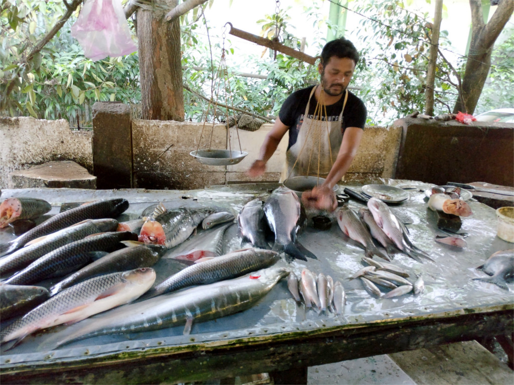
Periodic flooding, which helps replenish the fertile soil of the river valley is also responsible for great misery. But when the roads along the river are rendered un-motorable, the river highway of the Brahmaputra provides a welcome respite to the besieged people of the valley. The people in the Brahmaputra valley are used to this endless cycle of destruction and resurrection and have adapted well!
The boat is an emblematic representation of the river people’s endless struggle against the elements. During the warm and wet months, when entire villages are marooned, the Brahmaputra (navigable for almost 1,285 km upstream) allows vital supplies to be transported. The floating river ports on the Brahmaputra are characteristic of this region. Every manmade structure on the river, which includes markets and restaurants, is supported by barges to account for large variations in tidal levels. Surprisingly, for a river with such great religious and mythological significance, there are very few centers of pilgrimage along its banks. Parasuramkund on the Lohit River, (one of the tributaries of the Brahmaputra) is associated with the warrior sage Parasurama. It attracts millions of devotees who congregate here during the Hindu festival of Makar Sankranti (mid-January) when a big fair is held. Before the devastating earthquake which struck the region in 1950, Parasuramkund (or Brahmakund) was almost ringed in by a rocky wall that gave it the appearance of a small lake. The earthquake destroyed this natural dam and today the mighty river roars past a rickety bamboo fence that protects the pilgrims from the might of Brahma’s son.
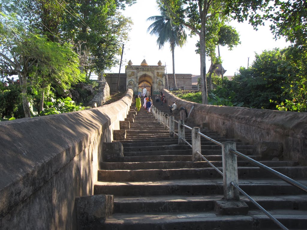
Guwahati, in the river’s middle course, has numerous hill shrines, the most important being the 16th-century Kamakhya Temple that is dedicated to the mother goddess and her various incarnates. This is the seat of tantric worship in northeast India and the day usually begins with animal sacrifices to appease Kali, a Hindu goddess associated with eternal energy. Hajo, 24 km from Guwahati is the best example of the Brahmaputra’s multi-religious makeup. This ancient pilgrimage center caters to the spiritual needs of three religions: Hinduism, Buddhism, and Islam. Just off Guwahati lies Peacock Island. On this stunted hillock in the middle of the Brahmaputra stands the 16th-century Umananda Temple dedicated to Shiva and his consort Uma. The temple is not the only attraction here; the island has a resident troop of Golden Langurs who enjoy the company of human beings.
Majuli near Jorhat was the center of the Neo-Vaishnavite movement. Until the 15th century, most people in Assam belonged to non-Aryan tribes who believed in animism and nature worship. Even in an organized religion like Hinduism, caste hierarchy encouraged violence and disunity. Since the 12th century, an experimental social reformist movement was making inroads across the country and slowly gaining acceptance. The Bhakti sect was born from Hinduism, but it was based on the liberal doctrine of Bhakti, or devotion. This movement gave birth to new ideas, even new faiths, and the Neo-Vaishnavite movement was born out of this experiment. In Assam, the proliferation of this movement is generally attributed to the social reformer and writer Srimanta Sankardeva. In the latter part of the 15th century, he ushered in a socio-cultural renaissance. Humanists in content and popular in form, it was incorporated in literature as well as the arts. This tradition still survives on the island of Majuli. Of the 46 major satras, only 26 remain today, most of which date back to the 16th century.
Today, many islands and villages along the Brahmaputra face extinction, but the river that has a reputation for being destructive also creates new landmasses. The landscape here is in a constant state of change. In unorganized settlements along the Sunderbans where the delta is vast, this does not seem to matter. People are nomadic and well-attuned to this predicament. Every monsoon, they shift their temporary residence and are constantly on the move, much like the river. But in an organized settlement like Majuli which has been shrinking continuously due to soil erosion, the socio-economic problem of resettlement becomes acute. The erratic nature of the river is best seen downstream, in Palashbari, approximately 30 km from Guwahati.
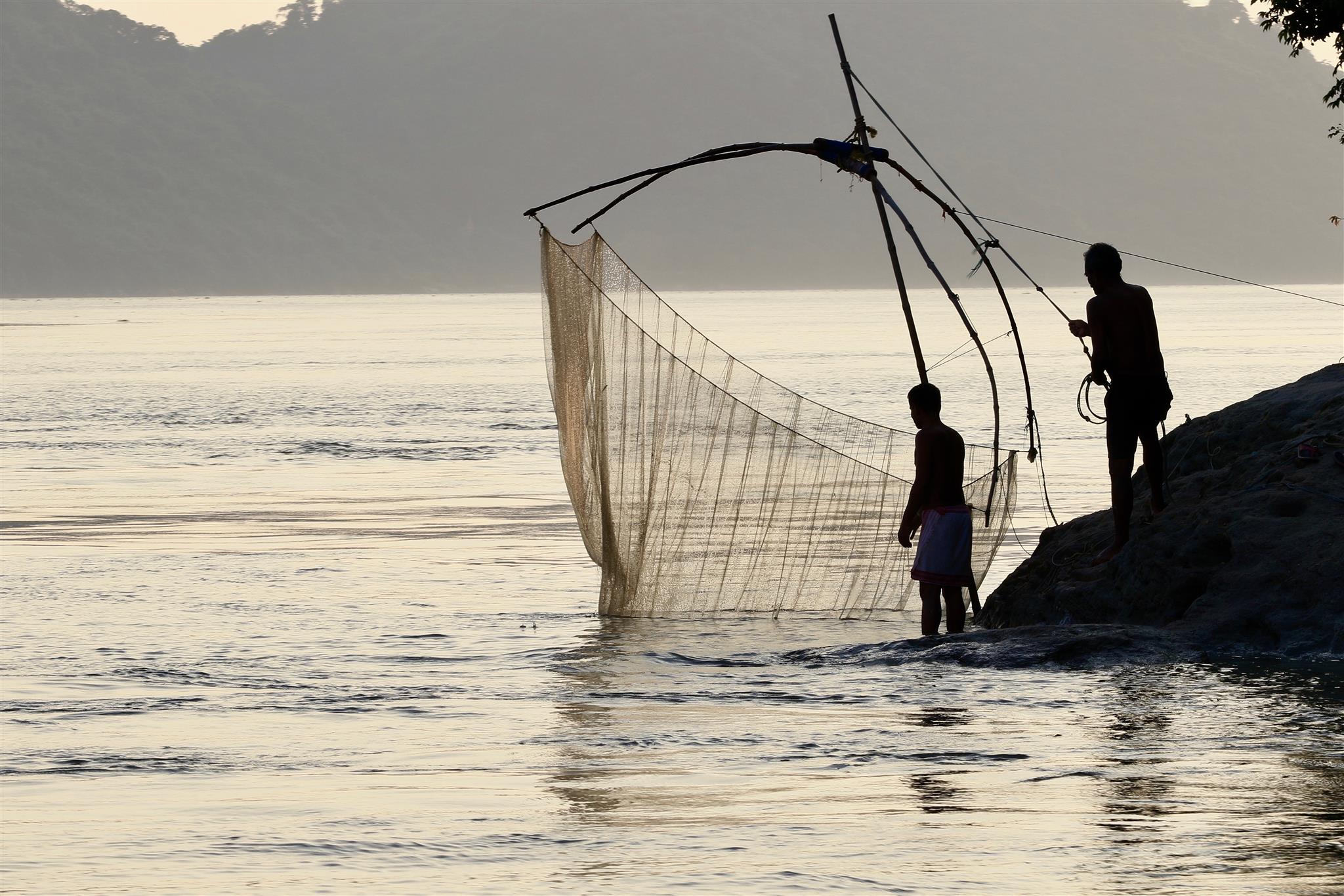
India is a country where the monsoon is normally associated with joy and celebration, but for the people of Palashbari, this is a season of sorrow. Every year, the river swallows a few kilometers of land here, while depositing silt on the opposite bank. Many residents have lost their agricultural land and have been forced to migrate to urban areas in search of work due to this crisis.

Beautiful Halebid
July 13, 2020 in Karnataka
This ancient capital of Hoysala was founded in the early 11th century and huge named Dwarasamudra, after a huge artificial lake dating back to the 9th century. The flourishing capital city had a small fortress with a magnificent palace. It was fortified with a wall of enormous boulders and a moat that was connected with the lake. Halebid attained glorious heights during the reign of Ballala -11, the grandson of Vishnuvardhana. The prosperity of Halebid attracted the forces of Delhi Sultanate, who invaded and annexed the town in 1311. In 1326, it was again attacked and ravaged by the forces of Mohammad bin Tughlak. Repeated invasions and the killing of king Ballala II, in the battle against the Sultan of Madura in 1342, forced the Hoysalas to relinquish their beautiful capital, which was then referred as Halebid’ or the ‘Old Capital’. The Hoysalas built over 150 exquisite temples in southern Karnataka, but the temples at Halebid, Belur, and Somnathpur are considered to be outstanding.
 Hoysaleswara Temple: This magnificent shrine dedicated to Lord Shiva is the largest and the best among Hoysala temples. Its construction was started in 1121, by “Ketumalla”, one of the officials of Vishnuvardhana and could be completed only by 1207. The shrine is very similar to the Chenna Keshava temple at Belur, but its figures are more profusely carved. Even after working diligently for about a century, there are still some unfinished portions of this amazing edifice. The sculptural extravaganza has been lavishly praised by the experts, critics, and common visitors. The complex consists of two identical temples, each with its array of navranga and sukhanasi and Nandi mandapas. Both the sanctums have a characteristic star-shaped ground plan and are set on a stone platform as seen in other Hoysala shrines. The temple on the northern side is named Shantaleshwara, after Shantala Devi, the beloved queen of Vishnuvardhana, while the southern side shrine is the Hoysaleswara temple. The two temple halls are joined by a common verandah creating a spacious columned interior. Thousands of intricately carved sculptures depicting scenes from the mythological epics Ramayana, Mahabharta, puranic legends, beasts, and beauties, etc. adorn the temple walls. There are about thirty-five thousand sculpted pieces in the shrine, noted for their breathtaking beauty, but the south doorway unrivaled for its filigree work is considered to be a masterpiece of delicate carving. The central figure portrays Lord Shiva with demon Andhakasur under his feet, while on either side of the lintel are Hoysala motif depicting a man single-handedly fighting a tiger. Both the sanctums enshrine a cast facing lingam, preceded by a Nandi mandapa with a huge statue of Nandi bul1, the celestial vehicle of Lord Shiva. There is an Archaeological Museum in front of the Hoysaleswara temple. Other attractions of Halebid are Kedareswara Temple, Basadi Halli (Jain Shrines), and Sri Ranganatha Temple.

Bijapur, ‘City of Domes & Minarets’
July 12, 2020 in Karnataka
Bijapur, the ‘city of domes and minarets’ was the capital of AdilShahi’s and is known as a treasure house of Islamic architecture’. The Chalukyan rulers of Kalyana originally founded Vijayapura or the ‘city of victory’, which came under the reigns of Bahmani rulers of Bidar in 1347. Yusuf Adil Shah, the Governor of Bijapur declared independence in 1481 and established the Adil Shahi dynasty. The Adil Shahi’s were great builders and Bijapur became a center for architectural activity. The town has about 50 mosques, 20 tombs, and numerous palaces and it is one of the ‘classic tourism’ destinations of India.
 Gol Gumbaz: It was built in 1626 – 1656, by Mohammed Adil Shah, as a mausoleum for himself and is recognized as “one of the finest structural triumphs of the Indian builders”. The four minarets have four staircases, leading to the top of the enormous dome, measuring 44 meters. in diameter. It is regarded as the second largest dome in the world, unsupported by a pillar. A circular ‘Whispering Gallery’ underneath is famous for its amazing acoustical system, where the faintest whisper is echoed 9 times. On a raised platform in the center of the hall are the replica tombs of Mohammed Adil Shah and his family, while the actual tombs lie in a crypt below. The gallery around the dome affords a fine view of the city.
The Fort: The huge fort built by Yusuf Adil Shah-I, has relics of palaces and pleasure gardens. Gagan Mahal was built in 1561, as a royal residence as well as Durbar Hall. The Sat Manzil, the seven storeyed palaces of Mohammed Adil Shah and the Jala Manzil are noted for its architectural beauty. Another attraction is the Maliki Maidan, a 55 tonne, 4.3 meters. long cannon of Adil Shahi’s, which is perhaps one of the largest bell metal guns in the world. Bara Kaman, located nearby is the incomplete mausoleum of Ali-II and is noted for its graceful arches.
Jama Masjid: This largest and oldest mosque of Bijapur was built by Adil Shah -I between 557 and 1686. The finely proportioned, rectangular mosque is known for its graceful minarets and bulbous domes. Aurangzeb added a grand entrance and painted the floor with 2,250 mullahs (space for prayers).
Ibrahim Rauza (2 kms.): This exquisite group of buildings lies on the western outskirts of the city. The palatial mosque and tomb with delicate minarets at each corner are regarded as one of the most beautifully proportioned Islamic structures in the country and an inspiration for the famous Taj Mahal.
Asar Mahal (5kms.): It was built in 1646 by Muhammad Adil Shah as ‘Hall of Justice’ and has some holy relics of Prophet Mohammed. Other interesting monuments are the Mehtar Mahal, Jod Gumbaz, Afzal Khan’s Cenotaph, Anand Mahal, Ark-Killa, etc.

Serene Sravanabelagola
July 12, 2020 in Karnataka
Serene Sravanabelagola, literally meaning the ‘Monk of the White Pond’ is one of the oldest and most important Jain pilgrim centers in the country. Its antiquity dates back to 297 B.C., when Chandragupta Maurya, the founder of the Mauryan empire renounced his kingdom and came here along with his guru, Bhagwan Bhadrabahu Swami, to become a Jain ascetic. He led a recluse life and breathed his last at the Chandragiri hill, which is named after him.
 Gomteshwara Temple: The temple atop the 470 ft. high Indragiri hill is dedicated to Lord ft. Gomteshwara or Bahubali, the younger son of Jain emperor and the first Jain Tirthankara, Vrishaba Deva (Adinath). It is world-renowned for the 58 feet and 8 inches tall sculpture of the Jain sage Gomateswara, which is regarded as the tallest monolith in Asia. The splendidly sculpted monolith is set in the middle of the temple courtyard encircled by a gallery enshrining the images of various Jain Tirthankaras. It was carved out of a single block of granite by sculptor Aristenemi in 981 A.D. and installed in 983 A.D. by Chamundaraya, a powerful minister of Ganga king, Rajamalla IV. The statue stands upright in the posture of meditation known as kayotsarga, indicating perfect self-control and its nakedness suggests complete renunciation of worldly things. It has curly hairs, long and large ears and eyes are open, gazing at the world with detachment. The perfectly chiseled facial features with a serene smile embody calm vitality. The figure has no support from the thighs upwards and shows an anthill growing in the background and creepers and snake emerging from it. The intricately carved creepers entwined on the legs and arms of the figure, culminating as a cluster of flowers and berries at the upper portions of the arms. The image is shown standing on a beautifully carved lotus pedestal.
The sacred shrine is accessible by a flight of 641 rock-cut steps. One can also hire a Doli or chair to reach the shrine. On the way up, there are several Jain bastis or temples.

Mysore, ‘the cultural capital’ of Karnataka
July 12, 2020 in Karnataka
Majestic Mysore, the city of palaces and parks is the ‘cultural capital’ of Karnataka. The historical town has legendary origins and its name is said to be derived from the word Mahishasurana Ooru”, which means the town of Mahishasura. According to a mythological legend, Mahishasura, the demon king, once lived here and was killed by Goddess Chamundeshwari. The Ganga kings ruled here till 10th century and were succeeded by the Cholas, Hoysalas and the Vijayanagar kings. Mysore became the glorious capital of the Wodeyar’s, feudatories of the Vijayanagar Empire, who declared independence in the 16th century with the decline of the Vijayanagar empire. The Wodeyar rule was disrupted for some time when Hyder Ali took over the reins of Mysore in 1765. His son Tipu Sultan developed the kingdom rapidly but was defeated by the British in 1799, and Mysore was given back to the Wodeyar’s.
 Mysore Palace: This magnificent three-storeyed palace in the heart of the town was built between 1897 1912 on the foundation of an old palace that was partially destroyed in a fire in 1897. The palace has splendid square towers at cardinal points, crowned with domes. The main attractions are – ‘Durbar Hall’ with its ornate ceiling and sculpted pillars and the Kalyanamandapam (Marriage Pavilion), noted for its chandeliers, cast-iron pillars, Belgian stained glass arranged in peacock designs in the domed ceilings and glazed tiled flooring. The palace is also known for its rich collection of priceless articles like a golden howdah (elephant seat), fine paintings, and a 200 kg. gold throne encrusted with precious stones. About 97,000 electric bulbs light up the palace in the evenings on Sunday, Public Holidays and during the Dassara celebrations.
Sri Jayachamarajendra Art Gallery: The art gallery is housed in the Jaganmohan Palace, one of the most beautiful buildings of Mysore. A museum established here in 1915, has a fine collection of ceramics, sandalwood, ivory, stone, antique furniture, and ancient musical instruments. It also treasures valuable art collection like traditional Mysore gold leaf paintings and paintings of renowned artists like Travancore ruler, Raja Ravi Varma, and the Russian painter Svetoslav Roerich, etc.
Rail Museum: It exhibits locomotives and coaches of the erstwhile royal family of Mysore. There are also paintings and photographs describing the story of the railways.
Folklore Museum: The museum at Jayalakshmi Vilas mansion has a rich collection of over 6500 folklore articles and is perhaps the biggest of its kind in Asia.
Mysore Zoo or Sri Jayachamrajendra Zoological Gardens: It was set up in 1892, during the rule of Chamrajendra Wodeyar.
St. Philomena’s Cathedral: The imposing twin-towered Gothic structure with beautiful stained glass windows.
Around Mysore
 Lalitha Mahal Palace (9 kms.)
The charming white colored double storeyed palace was built by Maharaja Krishnaraja Wodeyar in 1931, to accommodate the royal guests from overseas and has now been converted into a luxurious heritage hotel.
Chamundi Hill (13 kms.)
The Chamundeswari Temple perched atop the hill is believed to be 2,000 years old, but the present structure dates back to the 11th century. It is dedicated to Goddess Chamundi, the patron deity of the Wodeyar’s. On the halfway up there is a 4.8-meter tall monolith of ‘Nandi’, the bull, carved out of a single black rock. There is also a gigantic statue of Mahishasura atop the hill, who was vanquished in the battle by Goddess Chamundi.
Brindavan Gardens & Krishnarajasagar Dam (19 kms.)
The massive dam near the confluence of Kaveri, Hemavathi and Lakshamanatirtha rivers was designed and constructed by the famous architect M. Vishveswaraya in 1932, during the reign of Maharaja Krishnaraja Wodeyar IV. The dam is about 2621 meters long and 39 meters high, while the reservoir covers an area of 130 sq. kms. The beautiful terraced Brindavan Gardens, built at the foot of the dam is famous for its illumination and musical water fountains. The well – lit gardens in the evenings look like a fairyland.
Ranganathittu Bird Sanctuary (16 kms.)
It has a rich variety of water birds like a cormorant, egrets, and spoonbills, etc., but the sanctuary is mainly known for herons, who visit the islands for nesting and breeding. Their chicks are generally hatched in July and August. Best season- May to Nov.
Srirangapattana (16 kms.)
 The 18th-century island capital of Haider Ali and his son Tipu Sultan is flanked by two branches of river Kaveri. The battle-scarred ramparts of the fort reflect the heroics of Tipu, who valiantly fought the British and delayed their hegemony over Mysore. Within the fort is a mosque and the magnificent Ranganatha-Swamy temple, dating back to the 9th century, and evidence of Tipu. Tipu Sultan’s summer palace, Daria Daulatbagh, and his mausoleum are located outside the fort. The palace is noted for its gilded wall panels, ornate arches, and 18th-century frescoes.
Somnathpur (35 kms.)
Sacred Somnathpur is one of the three jewels of Hoysala temple architecture, the other two are Belur and Halebid. The Prassana Chennakesava Temple here was built in 1268, during the reign of King Narasimha III, at the instance of his minister Somanatha Dandanayaka. Like other Hoysala shrines, it is set on a raised plinth with a star-shaped ground plan, but unlike the Belur and Halebid temples, it was completed. The temple complex has a triple shrine (trikutachala), each with its own stunningly beautiful vimana and sukhanasi (vestibule) and a spacious common navaranga mandapa. The outer walls are exquisitely carved narrating episodes from Ramayana, Mahabharta, and Bhagavata.
Kabani River Lodge (80 kms.)
The jungle resort on the eastern fringes of famous Nagarhole Sanctuary has emerged as a popular tourist destination. The lush forest along the Kabani river teems with wildlife and birds and is a nature lover’s paradise.
Talakkad (45 kms.)
This historic and religious center on the left bank of Kaveri was the capital of Gangas from the 5th to 10th centuries. In 1116, Hoysala king Vishnuvardhana attacked Talakkad, under the Cholas and attained victory. To celebrate his victory, Vishnuvardhana built five temples dedicated to Lord Vishnu, one of them is the Kirtinarayan temple. Talakkad is also known for the five Shivalingas of the ‘Panch lingas’ enshrined in beautiful temples.
Sivasamudram (80 kms.)
The island town endowed with exceptional scenic beauty is 44 kms. from Mandya. It is famous for the two picturesque falls Gaganachukki and the Bharacukki created by the branches of river Kaveri. The Ranganatha and Someshwara Shiva temple are two important shrines of the island.
Melukote (48 kms.)
 Melukote or the High Fort’ is well known for the Panchanarayana temples, the five shrines dedicated to Lord Vishnu and built by the Hoysala king Vishnuvardhana. The famous Cheluvarayaswami temple atop Yadavagiri hill enshrines a fine statue of Lord Vishnu, holding the Shanku (conch), Chakra (a disc-like weapon) and a Gadha (mace).
Billigiri Rangana (BR) Hills (90 kms.)
BRHills are a delight for wildlife, trekking and adventure sports enthusiasts. The terrain is dotted with peaks and hilltop temples. Billigiri Rangana Temple dedicated to Lord Rangaswamy is the most important shrine. The Ratha (chariot) festival is held here in April. Other places worth seeing are – Dodda Sampige Mara, the 2,000-year-old giant tree, and BRT Wildlife Sanctuary. Bandipur National Park (80 kms.) It sprawls in the foothills of the Nilgiris and is one of the finest wildlife centers in the country. The park was set-up in 1931, by the Mysore Maharajas and was brought under the ‘Project Tiger in 1974. It covers an area of 874.20 sq. kms., kms., adjoining the famous Mudumalai sanctuary in Tamil Nadu and Wayanad sanctuary in Kerala Tha lush forest full of teak, rosewood, honor, math, bamboo and sandal trees teems with elephant, tiger, leopard, panther, dhole (wild dog). bison spotted deer, sambar, crocodile, cobra, and python, etc. Birds like peafowl, partridge. quail, hornbill, ibis, eagle, etc. can be viewed here. Visitors can take a safari on an elephant back or hire a vehicle to go round the park. Well planned motorable roads close to the perennial and seasonal water points and adequate open spaces in the forest enables a better viewing. Best season – May to June and Sept. to Nov.

Mangalore, the cleanest city!
July 12, 2020 in Karnataka
 Mangalore, the headquarters of Dakshin Kannada district is an important seaport town and a major export center of coffee and cashew nuts. The city flanked by the Western Ghats and the Arabian Sea has been a trading center for many centuries. Today, it is famous for beaches, backwaters, seaside fortress, architecture, and pleasant climate.
The Sultan’s Battery: Ruins of Tipu’s fort which once guarded the Naval station.
Kadri Temple: This spacious square-shaped temple complex is modern in layout and has unique seven tanks surrounded by swaying palm trees. The bronze statue of Lokeshwara is said to have been cast in 968 and is one of the finest bronzes in India.
St.Aloysius College Chapel: This relic of colonial past is known for fine murals, painted by Rev. Antonio Moscheni in the early 20th century. Other attractions include Mangladevi Temple and Rosario Cathedral etc.
Around Mangalore
Ullal Beach (11 kms.)
The sea-side village set on the mouths of two rivers is famous for the Summer Sands Beach Resort. Other beaches around are – Panambul (10kms.) and Suratakal (25kms.).
Mudabidri (34 kms.)
It is also referred to as Jain Varanasi’ and has 18 Jain bastis or monasteries. The most famous being the 1000 pillared Chandranatha Basti built-in1429. Karkal, located about 20 kms from Mudabidri has several important temples and a 13 m. high statue of Lord Bahubali, which was completed in 1432.
Dharmasthala (69 kms.)
Dharmasthala or the place of religion or faith’ is an important pilgrim center and a shining example of communal harmony and cultural tolerance. The main attractions here are the Manjunatha Temple and 14 meters. high Gomateshwara statue.
Sringeri (100 kms.)
The beautiful town on the banks of river Tungabhadra, amidst the lush hills, of Chikmagalur, is one of the most important pilgrim centers of Karnataka. The Sringeri Mutt herewith as founded in the 9th century by saint Sri Adi Shankara, the propagator of Advaitha phi 12th-century Vidyashankara temple was built here with the help of Vijayanagar rulers. It is a fine blend of the Hoysala and Dravidian style of architecture. The sanctum sanctorum enshrines a linga, called as Vidyashankara, in the memory of Guru Vidy 14th century shrine of Lord Janardhana is located nearby. Sringeri also has an old Jain Basadi (monastery).
Udupi (58 kms.)
This important Vaishnavite pilgrim cultural center is also famous for delicious South Indian cuisine. The Udupi Krishna Temple here is famous for the ‘Paryaya’ festival held once in two years.
Kallianpur (4 kms.): Relics of a fort built during the Vijayanagara period and shrines of Kenchamma, Veerbhadra, Mahalingeshwara, and Ganapathi.
Malpe (6 kms.): Tranquil beach resort. The beautiful St. Mary’s Island can be reached by boat from here.
Venur (50 kms.)
The sacred site is well known for an 11 meters high statue of Lord Bahubali, which was erected in 1604, on the southern banks of Gurupur river.

Hampi – The Ancient Village
July 12, 2020 in Karnataka
Historic Hampi, set on the banks of river Tungabhadra is world-renowned for the ruins of the glorious capital of the Vijayanagar empire. It was described by the Portuguese traveler Domingo Paes as “being as large as Rome” and the best-provided city in the world”. The famous capital was founded by the two brothers Hukka (Harihara) and Bukka in 1336. It was ruled by 23 kings from four dynasties, over 300 years. Under Krishnadevaraya and Achyutaraya, Hampi attained glorious heights. In 1564, they were finally defeated by the Muslim rulers of North India in the disastrous Battle of Talikota. Subsequently, the flourishing capital witnessed mass-scale pillaging. The magnificent city finally lapsed into decline and abandonment. Its ruins still reflect the glory of the bygone era and features on the list of the World Heritage Sites of UNESCO. Today, the ruins of Hampi are spread over an area of 27 sq. kms. and are a veritable open-air museum.
 Vitthala Temple: This magnificent temple complex is undoubtedly the best example of Vijayanagar art and architecture. Its construction was started in 1513, by Krishnadevaraya, but was not completed even after the shifting of the capital to Penukonda in 1565. The impressive Kalyana Mantapa and the exquisitely carved stone chariot in the courtyard are the main attractions. The technical conception is so ingenious that the stone wheels of the chariot rotate. Equally impressive are the 56 musical pillars in the large Ranga Mantapa.
Lord Virupaksha Temple: The temple complex is dedicated to Virupaksha, an aspect of Lord Shiva and the guardian deity of the Vijayanagar kings. Its exquisitely carved 50 m. high gateway was renovated in 1510, by Krishnadeva Raya. Within the temple, the courtyard is many small shrines and pillared halls.
Lotus Mahal: This graceful structure built in the women’s’ enclosure resembles the petals of a flower opening to the sun. Nearby are relics of a watchtower, which was once guarded by eunuchs. Royal ladies also watched the festivities from here.
 Ugra Narasimha: The 6.7 meters high splendid sculpture of Ugra Narasimha is seated under a canopy of seven hooded snakes, carved out of a single stone. To the left of the statue is a huge linga (Badavi linga) set under running water.
Mahanavami Dibba or the House of Victory: It was built by Krishnadevaraya afters Victorious expedition to Orissa. The spaces between the rows of the plinth- moldings are ornately carved.
Queen’s Bath: The square bath was surrounded by filigreed balconies. Lotus headed fountains once arched corridors, gallery verandahs, and projecting sprouted perfumed water in a minor waterfall into the pool. Some other attractions are the Elephant Stables and Hazara Rama Temple etc.
Around Hampi
Jog Falls
Jog Falls, the highest waterfalls in India are also ranked among the highest in the world. Sharavati river drops down from an elevation of over 900 ft., amidst the lush forest and creates four distinct cascades known as Raja, Rani, Roarer, and Rocket. ‘Raja’ – the highest among the four, plunges into the vapor shrouded pool. It is joined by ‘Roarer’, about 100 ft. below and then come ‘Rocket’ and ‘Rani’ cascades. The falls are more voluminous during the monsoons, but the most appropriate time to visit is from Dec. to Feb. A panoramic view of the Linganamakki dam can also be enjoyed from here.
 Kodagu
The charming district of Kodagu nestling amidst the lush Western Ghats is popularly known as the ‘Scotland of India’ and the Kashmir of the South’. Misty mountains, verdant valleys, serpentine streams, cascading falls, thick tropical forests, and miles of spice, paddy, and coffee plantations make the region a veritable paradise for nature lovers. The name Kodagu is said to derive from a Kannada word “Kudu” meaning steep or hilly. This “land of oranges, cashews, cardamoms, and coffee” is also known for its distinct cultural heritage and martial traditions.
Madikeri (Mercara)
The picturesque hill resort perched at an altitude of 4,000 ft. is the district headquarters of Kodagu. It was founded by Muddu Raja of the Haleri dynasty in 1681 and became the favorite resort of Britishers, as it reminded them of scenic Europe with lush hills and verdant valleys.
Raja’s Seat: This fine viewpoint is truly spectacular during sunset time.
Madikeri Fort: The hilltop fort was built by Lingarajendra Wodeyar II between 1812- 1814. It fort has a small museum in St. Mark’s Church.
Omkareswara Temple: This unique shrine in the middle of a lake is dedicated to Lord Vishnu and Lord Shiva. It was built by King Lingarajendra in 1820 and is a fine blend of Hindu and Muslim styles of architecture.
Abbey Falls: The beautiful falls are surrounded by coffee and pepper plantations.
Bhagamandala: The pilgrim center on the confluence of three rivers Kaveri, Kanika, and the underground Suiyothi is famous for Bhandeshwara temple.
Bylekuppe: It is one of the largest Tibetan settlements in South India and is famous for monasteries, handicrafts, carpet factories, and an incense factory.
 Iruppu Falls: The cascading falls descent down from a height of 170ft. in two distinct stages, amidst dense forests near the
Rajiv Gandhi National Park: The Rameshwara Temple near the Lakshmana Theerthariver, attracts a large number of devotees. Rajiv Gandhi National Park, Nagarhole (77 kms.) This delightful park covers an area of 284 sq. kms. along river Kabini. The jungles full of rosewood, teak, sandal, silver oak are a haven for rich and varied wildlife. The key fauna includes elephant, tiger, panther, gaur, deer, wild dog, langur, and reptiles like king cobra, etc. One can undertake jungle safaris on elephant back. The best season to visit is from June to October. The Heballa elephant camp is a must-visit site.
Tala Kaveri: It is the source for sacred river Kaveri, which originates on the slopes of Brahmagiri Hills. Every year on the auspicious occasion of Tula Sankaramana (17 October), a spring of water sprouts at a particular and foretold moment. Bathing in this water is considered to be very beneficial.

Gokarna Getaway
July 12, 2020 in Karnataka
It is one of the most important Hindu pilgrim centers of Southern India. Mythological legends suggest that Rudra (Shiva) arrived here shortly after the creation of the earth, squeezing through the ear of the earth and named it as “Gokarna or the ‘ear of the cow’. Gokarna is also an important beach resort and has several secluded beaches nearby.
 Mahabaleshwar Temple: The magnificent shrine is considered next in sanctity to Kashi Vishwanath temple in Varanasi. It is perched beautifully on a hillock near the beach and is famous for the Atmalinga. A mythological legend suggests, that the demon king Ravana appeased Lord Shiva through penance and obtained a Shivalinga with special powers from the Lord. Ganapathi and other gods were worried about the growing power of Ravana and decided to take away the Shivalinga from him. Ravana was on his way to Lanka and Ganapathi tricked him into putting the linga down on the ground at Gokarna for performing puja. Ravana was unable to lift the linga again and hence the linga is known as “Mahabal’, around which the Mahabaleshwar temple is built. Ravana was infuriated and tried to pull the linga out of the earth, but it broke into pieces and scattered in the nearby areas. These pieces are believed to be venerated at the temples of Dhareshwar, Gunavanthe, and Murudeshwar.
Kudle Beach: The lovely beach lies on the southern outskirts of Gokarna.
Om Beach: It resembles the auspicious Hindu symbol of Om’ and is located further south of Kudle beach. The secluded beach is worth visiting for its beauty.
Around Gokarna
Murudeshwar (76 kms.)
The pilgrim center is famous for the hilltop temple of Lord Shiva. View of the sea from the hill is breath-taking. A charming and clean beach is located nearby.
Yana (50 kms.)
The twin peaks of Bhairaveshwara Shikara and Mohini Shikara, surrounded by thick forests are venerated by the locals. A small shrine of Lord Shiva has a Shivalinga which is continuously bathed by a perennial stream.
Karwar (50 kms.)
This excellent beach resort and port town at the mouth of the Kali river is the district headquarters of Uttara Kannada. The town is also an angler’s paradise and is dotted with many picnic spots. The main attractions are Sadashivgad Hill Fort, known for the dargah (tomb) of Peer Shah Shamsuddin Kharobat and the Naganath temple; Baithkola Beach; Karwar Harbour; Muslin Factory and Dev Bagh Beach Resort.
